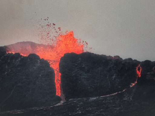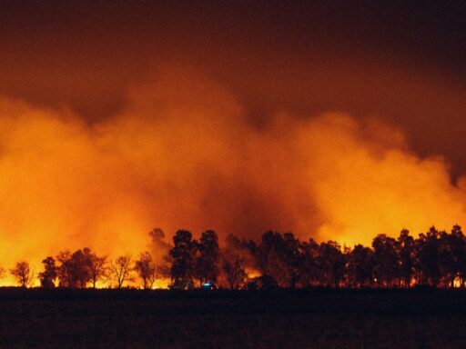
The Ferris Fire in southern Colorado has surged past 15,000 acres, with firefighters still reporting zero containment as hot, dry weather feeds the flames. The fast-growing blaze is now one of several major wildfires straining crews across the state, burning in rugged terrain that makes direct attack difficult and keeps nearby communities on edge.
As the fire expands, it is forcing a reshuffle of engines, aircraft, and hand crews that were already stretched thin by other incidents. What began as a local emergency has quickly become a regional priority, with state officials warning that the next few days of wind and heat could determine how far it spreads.
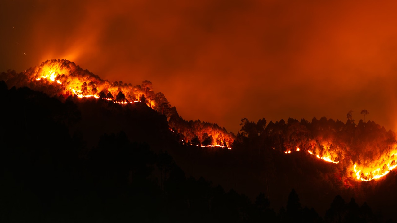
How the Ferris Fire exploded in size and complexity
State wildfire officials report that the Ferris Fire has burned more than 15,000 acres in western Fremont County, with no containment line yet holding along its perimeter. It is burning in steep, heavily timbered country dotted with dry grass and brush, conditions that have allowed it to run through drainages and up slopes faster than ground crews can keep pace.
The fire is one of several large incidents on Colorado’s active wildfire map, which also includes the Aspen Acres Fire near Beulah and Rye, the Snyder Mesa Fire in Mesa County, and the Gold Mountain Fire in the high country. In a statewide roundup, officials described how the Ferris Fire and its counterparts are competing for the same limited pool of engines, aircraft, and overhead staff, with the Ferris incident now listed among the largest active burns in the region according to a recent wildfire roundup.
Weather has been the key driver. A stretch of hot, dry afternoons, combined with single digit humidity and gusty winds, has pushed the fire through dense fuels that have not seen significant moisture for weeks. Fire behavior analysts on the incident have flagged torching trees, long-range spotting, and rapid uphill runs as recurring patterns. Those conditions make it risky to put firefighters directly in front of the head of the fire, so incident commanders have leaned on indirect tactics such as constructing control lines on more favorable ground and using aircraft to slow the most active flanks.
Access is another challenge. Much of the Ferris Fire footprint lies in roadless or lightly roaded country, where narrow, winding routes limit the ability of engines and bulldozers to get close. Crews have been hiking into spike camps, then working long shifts on hand lines that snake across ridges and through thick timber. Helicopters and air tankers have been dropping water and retardant on hot spots, but aviation resources are shared statewide and must rotate among several large fires.
Why the Ferris Fire’s growth is a statewide concern
The Ferris Fire is not burning in isolation. Its rapid expansion comes as other significant fires threaten populated areas, amplifying the risk to communities and infrastructure across southern Colorado. The Aspen Acres Fire has prompted evacuation zones that include the towns of Beulah and Rye and the well known Bishop Castle attraction, highlighting how quickly fire can move from the backcountry into residential areas when winds align with canyons and roads.
In that context, the Ferris Fire’s size matters because it demands a large share of the same resources needed to protect those communities. Type 1 and Type 2 hand crews, large air tankers, and incident management teams are finite. When a 15,000 acre fire with no containment is burning in rugged terrain, planners must decide how much to commit there versus to fires already pressing against homes. The statewide update that flagged the Ferris Fire’s acreage also detailed how the Snyder Mesa and Gold Mountain fires are drawing on the same pool of personnel, underscoring the balancing act described in a recent Colorado wildfire update.
Smoke and air quality are emerging concerns as well. A fire of this size produces a sustained smoke column that can drift far beyond the immediate burn area. Depending on wind direction, communities in Fremont County and neighboring counties can see hazy skies, reduced visibility, and elevated particulate levels. That affects people with respiratory conditions, outdoor workers, and anyone spending extended time outside. Transported smoke from the Ferris Fire can also layer with emissions from the Aspen Acres and Snyder Mesa fires, creating a broader regional air quality problem.
Ecologically, the fire is burning through a mix of forest and shrubland that has accumulated heavy fuel loads. In some places, low to moderate intensity fire can reduce that fuel and promote regeneration. In other pockets, especially where drought stress is severe, high intensity runs can kill large swaths of mature trees and leave behind hydrophobic soils that are prone to erosion. That raises concerns about post fire flooding and debris flows in the months after containment, particularly if monsoon storms arrive over freshly burned slopes.
For residents, the psychological impact is immediate. Even communities not yet under evacuation orders are watching the Ferris Fire’s perimeter maps and listening for updates on containment. The memory of previous Colorado fire seasons, including destructive events that reached into neighborhoods, shapes how people interpret a 15,000 acre blaze with no control lines yet holding. Local emergency managers have been urging residents to prepare go kits, review evacuation routes, and sign up for alert systems, since shifting winds can quickly change which areas are at risk.
How officials and communities are preparing for the next phase
Incident commanders on the Ferris Fire are racing to turn the current perimeter into something more defensible before the next round of hot, windy days. Their focus is on the most vulnerable edges of the fire, where spread toward homes, roads, or power infrastructure is most likely if the wind shifts. Crews are working to anchor and tie in control lines to natural barriers such as rock outcrops or previously burned areas, which can slow or stop the fire if conditions cooperate.
State and local agencies are also coordinating on evacuation planning, even in areas that are not yet under orders. The experience around Beulah and Rye, where the Aspen Acres Fire triggered evacuation zones that include entire towns and a major tourist site, has reinforced the value of moving early rather than waiting until flames are visible from backyards. In counties near the Ferris Fire, law enforcement and emergency management offices are reviewing trigger points for potential pre evacuation notices and formal evacuations, so they can act quickly if the fire crosses certain ridges or drainages.
At the same time, resource managers are looking beyond the immediate crisis. Once the Ferris Fire is contained, attention will shift to rehabilitation of fire lines, assessment of burned watersheds, and planning for future fuel treatments. The size and intensity of the fire will guide where to prioritize erosion control work, such as installing check dams or reseeding slopes to reduce the risk of post fire flooding. Land managers will also evaluate how the burn pattern aligns with existing fuel breaks and whether additional thinning or prescribed fire could help moderate future wildfires in the area.
For residents, the next steps involve both short term vigilance and longer term adaptation. In the near term, that means staying informed through official channels, preparing for possible evacuations, and reducing flammable material around homes, such as dry grass, wood piles, and overhanging branches. Over the longer term, communities near the Ferris Fire and other large burns will likely see renewed discussion of building codes, defensible space requirements, and land use planning that takes repeated wildfire exposure into account.
The Ferris Fire’s rapid growth past 15,000 acres, combined with zero containment and a statewide roster of other large fires, has turned it into a defining event of Colorado’s current fire season. How it behaves over the next several days, and how effectively crews can secure its edges, will shape not only the fate of nearby forests and watersheds but also the confidence of communities that now find themselves living with large wildfires as a recurring part of summer.