
Relentless heat across the mid-Atlantic and South finally cracked under the weight of thick, tropical air, exploding into thunderstorms that turned streets into rivers and interstates into hazard zones. As flash-flood warnings lit up phones from Washington, D.C., to the Gulf Coast, a familiar pattern emerged: a sweltering day followed by torrents of rain falling too fast for aging drainage systems to cope.
The shift from oppressive heat to dangerous downpours is no longer a rare weather quirk but a recurring pattern that tests infrastructure, emergency systems, and public patience. The latest round of storms shows how quickly a heat wave can flip into a flood emergency and how closely the two extremes are now intertwined.
How a heat wave primed the mid-Atlantic and South for flash flooding
Across the mid-Atlantic, a broad flood watch stretched from the suburbs of Washington, D.C., through parts of Maryland, Virginia, and into Pennsylvania as forecasters warned that slow-moving storms could drop intense bursts of rain over ground already baked by heat. In the nation’s capital, a flood watch highlighted the risk that narrow bands of thunderstorms could repeatedly track over the same neighborhoods, a setup that often produces localized but severe flash flooding.
Farther south, the same humid air mass that had kept heat indices in dangerous territory for days set the stage for explosive afternoon storms. As the upper-level pattern shifted, cooler air aloft moved over the region, turning that stored heat and moisture into towering thunderclouds. The result was short-lived but intense rainfall that overwhelmed creeks, storm drains, and low-lying roadways in cities that had just endured a stretch of extreme heat.
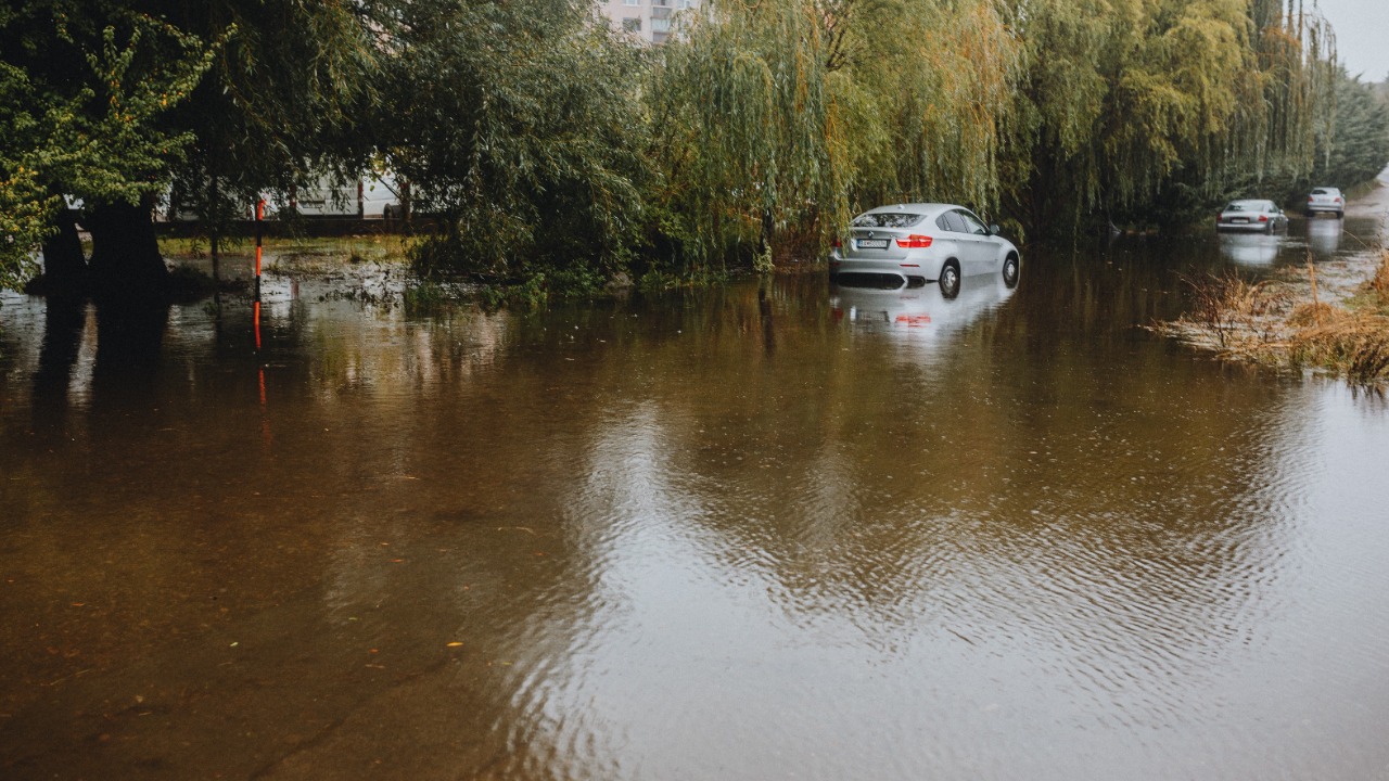
Along the Interstate 95 corridor, where millions of people rely on a single ribbon of pavement, those storms translated into stalled traffic and stranded drivers. Reporting on flash flooding along I-95 has repeatedly shown how quickly a routine commute can turn dangerous when heavy rain funnels into underpasses and poorly drained exits. Each new event adds to a familiar picture of cars trapped in rising water and emergency crews racing to close ramps that sit just a few feet too low.
In the South, the contrast between heat and storms was just as stark. A sprawling dome of high pressure had fueled a heat wave that pushed temperatures and humidity to levels that trigger widespread health alerts. As that dome shifted, thunderstorms erupted along its edges, dropping torrents of rain on communities from the Carolinas to parts of the Deep South that had already been under heat wave warnings. The same atmospheric setup that drove people indoors for safety from the heat then sent them scrambling from sudden flash floods.
Why back-to-back heat and flash floods are a growing concern
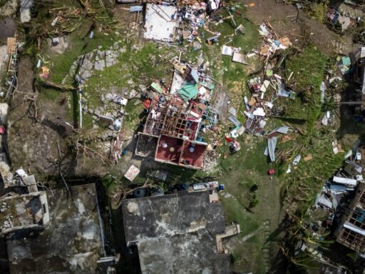
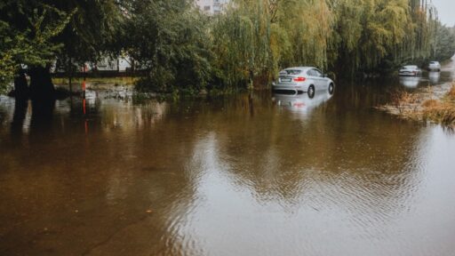
The immediate danger from these storms is obvious in the images that follow: submerged cars, flooded basements, and water rescues in neighborhoods that sit only a few miles from downtown office towers. Less visible, but just as significant, is the way that rapid swings from extreme heat to intense rainfall strain systems that were designed for a milder climate.
Stormwater infrastructure in many mid-Atlantic cities was built for rainfall patterns that assumed heavy downpours were rare. Now, convective storms repeatedly drop several inches of rain in a short window, turning what used to be a once-in-years event into something closer to a seasonal threat. When those storms arrive on the heels of a heat wave, the ground can be hard and dry at the surface, which encourages runoff rather than absorption. That combination helps explain why flash-flood warnings have become more frequent even in places that do not sit along major rivers.
Public health officials also worry about the compounding effects of heat and floods on vulnerable residents. During the heat phase, people without reliable air conditioning, including seniors and those in older housing, face elevated risks of heat exhaustion and heat stroke. When storms hit, many of the same residents live in basement apartments or low-lying blocks that are first to flood. Power outages that follow strong storms can knock out both cooling and sump pumps, extending the danger well beyond the initial burst of rain.
Transportation and commerce feel the impact quickly. When flooding shuts down sections of Interstate 95, the disruption ripples up and down the corridor. Freight shipments slow, commuters are delayed or stranded, and emergency responders struggle to reach calls that would normally be routine. Airports and rail lines built near rivers or tidal inlets face their own flood risks, which can stack on top of weather-related delays elsewhere in the country.
Insurance markets are already reacting to this pattern of repeated, localized flooding. Neighborhoods that sit just outside traditional river floodplains are now seeing more frequent claims from intense storm runoff and overwhelmed drainage. For homeowners and small businesses, that can mean higher premiums or new requirements to carry flood coverage that had never been recommended before. As more events stack up, the financial burden spreads from individual properties to municipal budgets that must repair roads, culverts, and public buildings after each round of storms.
How communities are adapting to a new storm rhythm
Local governments in the mid-Atlantic and South are beginning to adjust their playbooks as heat waves and flash-flood events increasingly arrive as a package deal. Emergency managers now treat extended heat advisories as a potential precursor to flood operations, pre-positioning high-water vehicles and swift-water rescue teams when forecasts call for a break in the heat accompanied by strong thunderstorms.
Cities are also rethinking their infrastructure in light of repeated flooding. Projects to enlarge culverts, separate stormwater from aging sewer systems, and add green infrastructure such as rain gardens and permeable pavements are moving from pilot programs to core capital plans. These upgrades are costly and slow, but each new round of flash floods strengthens the argument that the status quo carries its own price in property damage and disruption.
Communication strategies are evolving as well. Weather alerts that once focused on either heat or storms now increasingly highlight the sequence: first dangerous heat, then a shift to severe thunderstorms with flash-flood potential. Officials are encouraging residents to treat both phases as part of one hazard cycle, which means checking gutters and drains before storms arrive, avoiding underpasses and low crossings during heavy rain, and having a plan to reach cooler, safer shelter if power fails after the storms.
At the neighborhood level, community groups and local nonprofits are filling gaps that formal systems cannot always reach. Cooling centers that open during heat waves are beginning to double as information hubs for storm readiness, sharing guidance on flood-safe parking, basement protections, and how to document damage for insurance and aid. Volunteer networks that check on older residents during heat advisories are extending those wellness checks through the storm phase, when mobility and access can be even more limited.
What to watch as heat and flood risks rise together
The pattern that just played out across the mid-Atlantic and South is likely to repeat, which raises practical questions about how prepared communities really are for a climate in which heat and flash flooding often arrive in tandem. One key test will be whether infrastructure upgrades can keep pace with the frequency of intense storms. Cities that move quickly to modernize drainage, elevate vulnerable road segments, and expand green spaces that absorb water may see fewer catastrophic floods even if the storms themselves grow more intense.
Another factor is how effectively public agencies can tailor warnings to specific neighborhoods. Broad flood watches are useful, but residents are more likely to act when alerts speak directly to familiar landmarks, such as a particular creek, underpass, or intersection that has flooded before. Investments in high-resolution forecasting and real-time gauge networks could help narrow the gap between regional alerts and block-by-block risk.