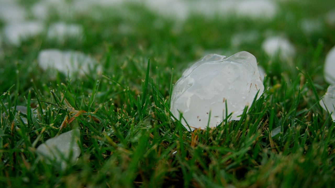

Connecticut’s Fourth of July storms may have produced the largest hail ever recorded in the state, after preliminary reports showed hailstones around 3 inches in diameter in the Bristol area. That is larger than a baseball and, if verified, would beat Connecticut’s current official hail-size record.
According to CT Insider, the National Weather Service logged a preliminary report of 3-inch hail in Bristol during the holiday storms. The report noted that Connecticut’s current largest hailstone record is 2.75 inches, set in Ellington and Lyme on June 20, 1995. That means the July 4 hailstone could become a new state record if the measurement is confirmed.
The word “may” matters here. Severe-weather reports often begin as preliminary observations from residents, trained spotters, emergency managers, radar data, or local officials. Before a state record becomes official, meteorologists and climate authorities usually need to verify the evidence carefully.
Why 3-Inch Hail Is So Unusual in Connecticut
Hail this large is rare in Connecticut because the state does not usually experience the same type of extreme hail environment seen more often in the Great Plains. Large hail requires strong thunderstorm updrafts that can keep ice suspended inside a storm long enough for it to grow layer by layer.
A hailstone around 3 inches wide is larger than a standard baseball, which is roughly 2.9 inches in diameter. That size can crack windshields, dent vehicles, damage roofs, break skylights, shred plants, injure animals, and seriously hurt anyone caught outside.
The National Weather Service warns that large hail can cause significant damage and injury. Even hail much smaller than baseball size can be dangerous when driven by strong thunderstorm winds.
Where the Largest Hail Was Reported
The most notable preliminary report came from Bristol, where 3-inch hail was logged. Reports of smaller but still damaging hail also came from nearby areas, including Plainville and New Britain. The storms moved through parts of Connecticut during a busy holiday period, when many people were outdoors for cookouts, travel, fireworks, and Independence Day gatherings.
The CT Mirror reported that baseball-sized hail fell in parts of Connecticut and that the storms left more than 100,000 people without power. The same report said the storm complex moved through the southern half of southern New England, producing damaging winds, heavy rain, and large hail.
That combination made the event more than a hail story. It was a broad severe-weather outbreak that disrupted holiday plans, damaged property, knocked down trees, and forced cleanup crews into action.
Why Verification Takes Time
A hail report can look convincing, but official record verification is more careful than measuring a stone in someone’s hand. Meteorologists may review photos, videos, time stamps, location information, radar signatures, storm reports, and whether the hailstone was measured before it melted or was altered.
Hailstones can melt quickly, especially in summer heat. A 3-inch stone measured several minutes after falling may have been even larger when it hit the ground. But the opposite problem can also happen: photos without scale, rounded estimates, or damaged ice pieces can make size confirmation difficult.
The National Centers for Environmental Information maintains the Storm Events Database, which includes verified reports of hail, damaging winds, tornadoes, floods, lightning, and other severe weather. Final storm records often take time because they go through review before appearing in official databases.
How Hail Forms Inside a Severe Thunderstorm
Hail forms when strong updrafts lift water droplets into freezing parts of a thunderstorm. The droplets freeze into small ice pellets. If the storm’s updraft is strong enough, those pellets can remain suspended and collect more layers of ice.
The hailstone grows as it is carried upward and downward through the storm. Eventually, it becomes too heavy for the updraft to hold, and it falls to the ground.
Large hail usually requires a powerful storm environment with strong instability, deep moisture, cold air aloft, and strong vertical wind shear. In Connecticut, that combination does not happen as often as it does in traditional hail-prone regions, which is why a possible 3-inch hailstone is so remarkable.
Why Heat Helped Fuel the Storms
The Fourth of July storms formed after a period of intense heat and humidity across the region. Hot, humid air can provide the energy thunderstorms need to grow quickly. When that unstable air interacts with stronger winds higher in the atmosphere, storms can become organized and severe.
This is likely why the holiday storms produced both damaging wind and large hail. CT Insider reported that the severe storm development was fueled by existing heat and humidity along with strong upper-level winds. Those ingredients helped storms organize into damaging clusters and bowing segments.
In simple terms, the atmosphere had enough heat, moisture, and wind energy to turn ordinary summer storms into a more dangerous severe-weather event.
Why Large Hail Can Be More Dangerous Than It Looks
Many people think of hail mainly as a property-damage hazard, but large hail can also be a direct safety threat. A baseball-sized hailstone falling from a thunderstorm can strike with enough force to cause serious injury.
People outdoors during hail should move inside a sturdy building immediately. Cars are safer than open areas, but large hail can still break windows and injure passengers. Sheltering under trees is dangerous because severe storms can also produce falling limbs and lightning.
The Ready.gov thunderstorm guide recommends going indoors when severe storms approach and staying away from windows. Large hail, lightning, and damaging winds can arrive quickly after a warning is issued.
Damage Went Beyond Hail
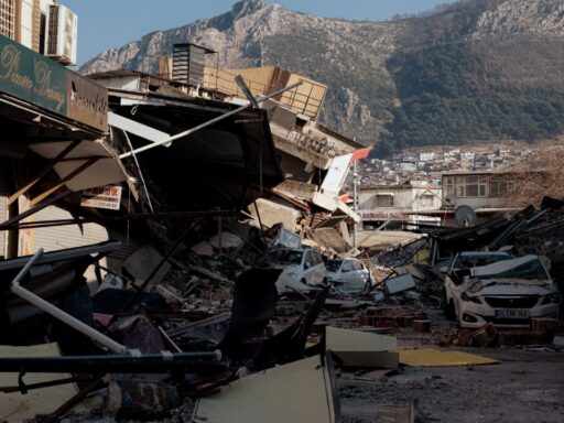
The July 4 storms also caused widespread wind damage. Downed trees and power lines blocked roads, damaged homes, and disrupted electricity across parts of the state. Power outages affected more than 100,000 customers at the height of the storm, according to local reports.
This kind of damage often comes from straight-line winds or downbursts rather than tornadoes. Straight-line winds can still be destructive, especially when storms organize into bowing segments that push powerful winds across a wide area.
For residents, the distinction between a tornado and damaging straight-line wind may not matter much in the moment. Both can bring trees down, damage roofs, block roads, and threaten people outside.
Why Severe Storms Can Surprise New England
New England is not usually viewed as a classic severe-storm hotspot, but it still experiences damaging thunderstorms. Connecticut can see hail, wind damage, tornadoes, flash flooding, lightning, and microbursts, especially during warm, humid summer patterns.
The danger is that people may underestimate storms because they are not in the Plains or Deep South. A severe thunderstorm warning in Connecticut still deserves serious attention. Large hail and damaging winds can develop quickly, and storms can move fast.
The Fourth of July timing also increased exposure because many people were outside. Holiday gatherings, beach trips, backyard events, sports, and fireworks plans can all put more people in vulnerable places when storms arrive.
What Makes a Hailstone a State Record
A state hail record is based on the largest verified hailstone diameter. The measurement must be credible, documented, and reviewed. Meteorologists may compare the report with radar signatures showing hail potential, storm structure, and local observations.
The previous Connecticut record of 2.75 inches was already very large for the state. A 3-inch hailstone would exceed it by a quarter inch. That may sound small, but in hail records, fractions of an inch matter.
A 3-inch diameter stone also represents much more mass and impact energy than smaller hail. The damage potential rises quickly as hailstones grow because larger stones fall faster and hit harder.
Why Radar Is Important
Modern weather radar can help identify storms capable of producing large hail. Dual-polarization radar can distinguish different types of precipitation and estimate hail signatures inside a thunderstorm. Meteorologists use radar data along with ground reports to understand storm severity.
However, radar cannot replace ground truth. A radar may show a strong hail core, but the actual size reaching the ground depends on melting, wind, storm motion, and where the strongest core passes. That is why photos, measured stones, and spotter reports remain important.
When a possible state record occurs, radar helps support the meteorological case, but the physical evidence still matters.
How Residents Should Report Large Hail
Residents who safely observe large hail can help meteorologists by reporting it accurately. The best reports include the exact location, time, estimated or measured diameter, photos with a clear scale, and whether damage occurred.
A ruler, tape measure, coin, or common object can help show size, but a direct measurement is best. Photos should be taken quickly before melting changes the hailstone’s size. Safety comes first, though. No one should go outside during active hail, lightning, or damaging winds to collect evidence.
The National Weather Service storm reporting page provides guidance for submitting severe-weather reports. Accurate reports help warning meteorologists, emergency managers, climatologists, and researchers.
What Homeowners Should Check After Large Hail
After a severe hailstorm, homeowners should inspect property carefully once conditions are safe. Roof shingles, gutters, siding, skylights, windows, vents, decks, garden structures, and vehicles may show dents or cracks.
People should avoid climbing on roofs during cleanup unless trained and properly equipped. Roof damage may not be obvious from the ground, but unsafe climbing can create another emergency. Professional inspections may be needed when hail is large enough to damage roofing materials.
Vehicle owners should photograph damage before repairs, contact insurance providers, and avoid scammers who appear after storms offering quick repair deals. Severe-weather events often attract fraudulent contractors.
Why Insurance Claims May Rise
Baseball-sized hail can produce expensive claims. Roof replacements, windshield repairs, bodywork, siding repairs, broken windows, and cleanup costs can add up quickly across a region. Even a localized hail core can damage many vehicles and homes in a short period.
Insurance companies may use weather data, radar reports, photos, and official storm records to verify claims. If the 3-inch hail report is confirmed, it could support damage documentation in the affected area.
Homeowners and renters should save photos, repair estimates, receipts, and communication with insurers. Clear documentation can make storm recovery easier.
Climate Change and Hail Are Complicated
The relationship between climate change and hail is more complex than the relationship between climate change and heat waves. Warmer air can hold more moisture and fuel stronger storms, but hail formation also depends on freezing levels, storm structure, wind shear, and updraft strength.
Some research suggests that environments capable of producing large hail may change as the climate warms, but local trends vary and remain an active area of study. It is safer to say that extreme thunderstorm hazards are influenced by multiple ingredients, and scientists continue to study how those ingredients are changing.
What is clear is that communities need to prepare for severe storms even in places where giant hail is rare. Rare does not mean impossible.
Final Takeaway
Baseball-sized hail fell in parts of Connecticut during the Fourth of July storms, and a preliminary 3-inch hail report from Bristol may have set a new state record. If verified, it would exceed Connecticut’s current largest hailstone record of 2.75 inches.
The storm was part of a severe holiday weather outbreak that also brought damaging winds, downed trees, power outages, and widespread disruption. Heat, humidity, and strong upper-level winds helped create the kind of storm environment capable of producing unusually large hail.
The key point is caution. The record is not final until officials verify the report, but the event already shows how dangerous summer thunderstorms can become in New England. Large hail is not just a curiosity. It can damage property, injure people, and turn a holiday storm into a record-setting weather event.