
Tropical Storm Arthur formed off the Texas coast before the official start of the Atlantic hurricane season, a reminder that the calendar is a guideline, not a shield. Yet even with that jump start, federal forecasters now expect fewer storms than average in the Atlantic this year, a shift that is changing how coastal communities frame their risk.
Rather than bracing for another hyperactive year, emergency managers are preparing for a season that could be quieter overall but still dangerous if even one storm tracks toward a vulnerable shoreline.
How NOAA’s new forecast reshaped expectations after Arthur
The National Oceanic and Atmospheric Administration has issued its first below-normal outlook for the Atlantic since 2015, projecting fewer named storms and hurricanes than the long-term average. In its official season forecast, the agency describes a basin that looks less favorable for storm formation, with large-scale atmospheric patterns expected to tamp down development.
This forecast arrived in the shadow of Tropical Storm Arthur, which spun up near the Texas coast as the first named system of 2026. Arthur formed before the season’s traditional June 1 start, bringing heavy rain and thunderstorms to parts of the western Gulf. Local coverage along the coast highlighted how Arthur’s formation briefly raised fears that an early storm might signal another relentless year.
NOAA’s updated analysis instead points to a different pattern. The agency cites a strong El Niño in the Pacific that is expected to increase wind shear over the Atlantic, a setup that typically disrupts tropical systems as they try to organize. Reporting on the outlook explains that forecasters now see a higher chance that the number of storms, hurricanes, and major hurricanes will fall below the 30-year average, a break from the string of active seasons that has defined the past decade.
Independent coverage of the outlook notes that this is the first time in years that NOAA has leaned clearly toward a quieter Atlantic, and that the shift reflects both ocean temperatures and evolving climate drivers. One analysis of NOAA’s hurricane outlook emphasizes that the agency is still allowing for a wide range of possible outcomes, but the most likely scenario features fewer storms than the recent barrage of above-normal years.
The forecast also comes as local meteorologists track additional disturbances in the Gulf of Mexico. Coverage focused on whether potential Gulf storm might affect Alabama underlines that even in a projected slow year, short-term tropical threats will continue to pop up and demand attention.
Why a “below-normal” season still carries high stakes
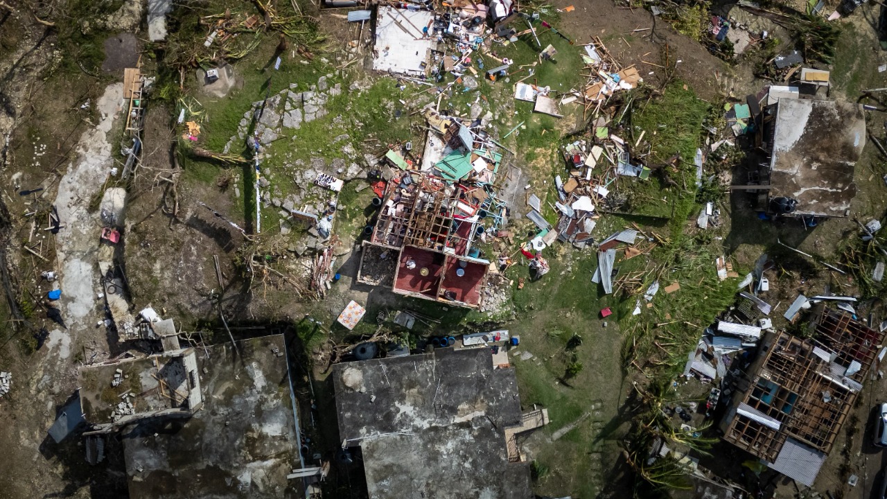
A quieter outlook does not translate to low risk for coastal residents. NOAA’s own messaging stresses that it takes only one landfalling hurricane to turn a season into a disaster for any given community. Analysts reviewing the new forecast point out that some of the costliest and deadliest storms on record have occurred in years that were not especially busy overall.
Population growth along the Atlantic and Gulf coasts has outpaced investments in resilient infrastructure. New subdivisions in places like coastal Texas, the Florida Panhandle, and the Carolinas sit close to sea level and rely on drainage systems that can be overwhelmed by slow-moving tropical storms. Arthur’s heavy rain over Texas, which produced pockets of flooding even as a relatively weak system, offered a small preview of how vulnerable low-lying neighborhoods remain when intense rainfall coincides with saturated ground or high tides.
Emergency planners also worry that a below-normal label can lull people into complacency. Public information officers in hurricane-prone cities have already started to emphasize that the seasonal forecast is not a personal forecast. Their concern is that residents will misread the outlook as a guarantee, delay preparations, and then scramble if a storm threatens later in the summer or early fall.
Insurance markets add another layer of tension. In several coastal states, homeowners have seen premiums climb as insurers respond to recent years of heavy losses. A season with fewer storms could ease some of that pressure, yet a single major hurricane striking a densely populated corridor from Houston to Tampa or from Savannah to Norfolk could still produce billions in damage and keep rates high. The below-normal forecast may influence how reinsurers price risk, but it does not remove the underlying exposure of homes, roads, and power grids built close to the water.
For local governments, the outlook lands at a moment when budgets are tight and federal resilience funding is spread across flood control, wildfire mitigation, and heat adaptation. Some city councils are weighing whether to accelerate projects such as elevating evacuation routes, expanding shelter capacity, or strengthening wastewater systems against storm surge. A season with fewer expected storms might tempt decision makers to defer those investments. Forecasters and climate scientists argue that would be a mistake, since long-term sea level rise and warmer oceans continue to load the dice for more damaging storms over time even if a single year is relatively quiet.
How communities should navigate the months ahead
With Arthur already on the books and NOAA calling for a milder overall season, the next few months will test how well coastal regions can balance vigilance with realistic expectations. The official Atlantic season runs from June through November, and early June updates from meteorologists have already highlighted tropical waves emerging off Africa and disturbances bubbling in the western Caribbean.
Forecasters at the National Hurricane Center will continue to refine their guidance as new data on sea surface temperatures, wind shear, and atmospheric moisture arrives. Regional briefings referenced in coverage of the below-average forecast stress that residents should focus less on total storm counts and more on understanding local hazards such as storm surge zones and flood-prone creeks.
For households, that means treating the current outlook as a window of opportunity rather than a reason to relax. Emergency managers continue to urge families to review evacuation routes, assemble go-kits with medications and important documents, and check that vehicles are in good enough condition to handle a long drive inland if needed. Residents in older homes or manufactured housing are being encouraged to identify sturdier places where they could stay if a hurricane watch is issued.
Businesses along the coast also have decisions to make. Port operators, refineries, and chemical plants in Texas and Louisiana rely on detailed hurricane plans to secure equipment and manage shutdowns. A season with fewer storms might reduce the number of disruptions, but companies still need to rehearse those procedures and ensure that backup power, fuel supplies, and communication systems are ready for a worst-case track.
Schools and universities, many of which serve as shelters during evacuations, are reviewing building codes and generator capacity before the peak of the season. Some districts are coordinating with local emergency management to pre-stage cots and medical supplies so they can convert gyms and cafeterias quickly if a storm threatens during the school year.
At the neighborhood level, local leaders have an opportunity to strengthen social networks that often determine who gets out in time. Community groups in low-lying areas are organizing phone trees and volunteer driver lists to help elderly or carless residents evacuate. Faith-based organizations and mutual aid groups are mapping which members have spare rooms, generators, or chainsaws that could be shared after a storm.
Even if NOAA’s below-normal forecast verifies, the season will still produce named storms, and at least some will approach land. Arthur’s early appearance near Texas showed how quickly a disturbance can spin up close to shore, leaving little time for preparation. The lesson from forecasters is straightforward: treat the quieter outlook as a piece of context, not a shield, and use the relative breathing room to get ready before the next name on the list appears on the map.