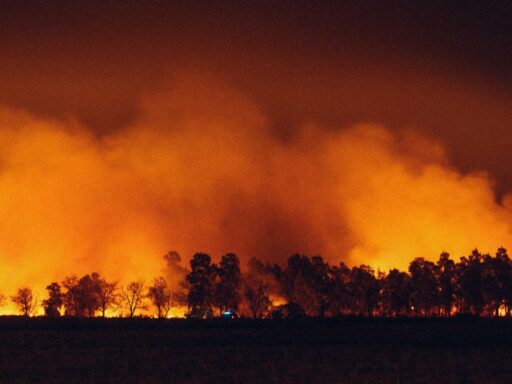
A fast-moving wildfire known as the Gold Mountain Fire has burned 4,275 acres in Ouray County, Colorado, turning a remote corner of the San Juan Mountains into the latest flashpoint in a difficult start to the state’s fire season. The blaze has forced evacuations, strained local firefighting resources, and added to a growing list of significant wildfires that are testing Colorado’s preparedness as hot, dry weather persists.
What began as a localized incident has quickly become one of the larger active fires in the state, raising concerns about how far it might spread and how much more damage it could cause if weather and terrain continue to favor the flames.
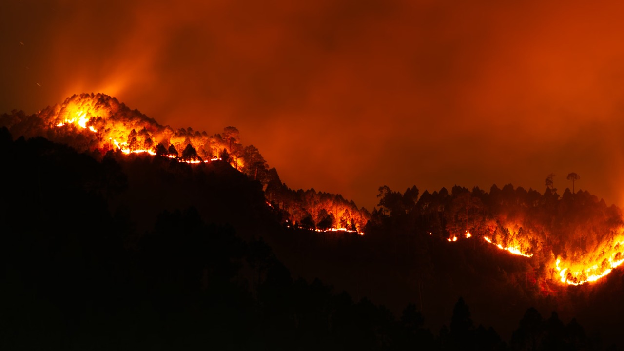
Recent escalation of the Gold Mountain Fire in Ouray County
The Gold Mountain Fire is burning in steep, rugged country in Ouray County, where heavy fuels and limited road access complicate every tactical decision. According to state wildfire tracking, the incident has grown to 4,275 acres, a size that immediately places it among Colorado’s most significant active burns and demands a coordinated response from local, state, and federal crews. That acreage figure comes as part of a broader snapshot of Colorado wildfires that have flared across the state as temperatures climbed and humidity dropped.
Fire managers describe a pattern that has become familiar in recent years. Initial attack resources are dispatched quickly, but once flames establish themselves in dense timber or mixed conifer on steep slopes, containment becomes a long, grinding effort. In Ouray County, crews are contending with narrow canyons and limited escape routes, which restrict where firefighters can safely engage the fire’s edge and often require more indirect tactics such as building control lines on ridges and using natural barriers.
Reports on active incidents across Colorado show that the Gold Mountain Fire is growing in the context of multiple other large burns, including fires in southern and central parts of the state that have already prompted evacuation orders and structure protection efforts. A statewide roundup of current incidents notes that resources are being shifted daily to match the most immediate threats, which places added pressure on command teams trying to hold the Gold Mountain perimeter while also remaining ready for new ignitions.
Weather has been a key driver of the fire’s recent expansion. Hot afternoons, gusty winds, and periods of very low relative humidity have created conditions in which even small embers can travel ahead of the main fire front and start spot fires. Forecast discussions referenced in regional fire updates suggest that while some moderation is possible at times, the overall pattern remains favorable for continued burning, with only limited chances for widespread, soaking rain.
How the Gold Mountain Fire fits into Colorado’s wider 2026 fire picture
The Gold Mountain Fire is not an isolated event. It is one of several significant wildfires burning across Colorado, a list that includes the Aspen Acres Fire and other incidents that have forced evacuations in communities such as Beulah and Rye and prompted structure protection around landmarks like Bishop Castle. A statewide roundup of current incidents highlights how these multiple fires are unfolding at the same time, stretching resources and complicating strategic planning.
Statewide reporting on wildfires burning Colorado notes that crews are juggling suppression efforts from the Front Range to the Western Slope. That broader context matters for Ouray County because it shapes everything from how many engines and hand crews can be assigned to Gold Mountain to how much aviation support can be brought in during critical burning periods. When several large incidents are active, air tankers and helicopters must be prioritized, which can mean fewer drops on any single fire during peak demand.
For residents and local officials in Ouray County, the Gold Mountain Fire has quickly become a test of evacuation planning and communication systems. While detailed evacuation maps and road closure lists are managed by county authorities and incident command, regional fire coverage has already documented how other communities have had to move people out quickly as flames approached. That experience elsewhere in the state is informing how Ouray County leaders think about potential trigger points for additional evacuation warnings or orders if the fire shifts direction.
The fire’s location in a mountain county that relies heavily on tourism also adds another layer of concern. Ouray and neighboring communities market themselves as gateways to the San Juan Mountains, with summer visitors drawn to hiking, off-road trails, and scenic drives. Smoke, road closures, and the risk of fast-changing fire behavior can disrupt that seasonal economy even if structures remain standing. Businesses that depend on summer traffic must now navigate cancellations, shifting travel plans, and uncertainty about how long the incident will remain active.
At the same time, the fire is part of a broader conversation about how Colorado adapts to a longer and more intense fire season. Statewide coverage of June’s activity has already pointed to a combination of dry fuels, hot temperatures, and recurring wind events that give even small ignitions a chance to become large, complex incidents. In that context, the Gold Mountain Fire is both a local emergency and a data point in a larger pattern that policymakers and land managers are tracking closely.
Why the Gold Mountain Fire demands attention right now
The immediate concern in Ouray County is public safety. A detailed account of active incidents notes that the Gold Mountain Fire has already burned 4,275 acres, a footprint large enough to threaten homes, infrastructure, and backcountry recreation areas if containment lines do not hold. A focused report on the incident describes how the Gold Mountain Fire is forcing authorities to balance aggressive suppression with firefighter safety in difficult terrain.
Smoke impacts are another pressing issue. Even when flames remain in remote areas, smoke can drift into nearby valleys and towns, affecting air quality for vulnerable residents such as older adults, children, and people with respiratory conditions. Regional fire updates have already flagged smoke from multiple incidents affecting air quality across parts of Colorado, a trend that can intensify as more acres burn and as weather patterns trap smoke in mountain basins.
The fire also matters for what it signals about resource capacity. With several large incidents burning at once, Colorado’s firefighting system is entering a period of sustained high demand. That includes local volunteer departments, county emergency management offices, state wildfire agencies, and federal partners. Each new large fire adds to the workload, from logistics and planning to crew rest and mental health. The Gold Mountain incident is now part of that cumulative strain, and how it is managed will influence how ready the state is for additional events later in the season.
For land managers, the fire raises questions about fuel conditions in the high country. Years of drying in some forest types, combined with beetle-killed trees and dense undergrowth, have created large areas where fire can move quickly once it starts. While detailed post-fire analysis will come later, the current behavior of the Gold Mountain Fire is already giving incident commanders real-time information about how those fuels are responding to current weather and how control lines perform in this part of the San Juan region.
What to watch next as crews battle the Gold Mountain Fire
In the coming days, several factors will determine how the Gold Mountain Fire evolves. Weather will be the most important variable. Forecasts referenced in statewide fire coverage suggest that continued warm, dry conditions are likely, with only limited relief from scattered showers. If winds remain moderate and humidity rises at night, firefighters will have better opportunities to strengthen control lines. If gusty winds return during the hottest part of the day, the fire could test those lines and potentially push into new terrain.
Containment numbers will be another key metric. As crews complete line construction and conduct burnout operations where needed, incident command will update containment percentages to reflect how much of the perimeter is considered secure. Those figures, combined with satellite heat detections and field reports, will guide decisions about lifting or expanding evacuation zones and reopening roads and recreation areas.