Archaeologists in northern Peru have revealed that the striking geoglyph in the Chicama Valley was only one part of a far larger engineered landscape. Beside the giant earth figure, they have identified a roughly 100 hectare agricultural complex with canals, terraces and field systems that reshapes how this coastal valley is understood. The finds point to a society that invested heavily in both symbolic imagery and intensive food production on the edge of the desert.
New evidence from Chicama’s geoglyph and 100-hectare farmed zone
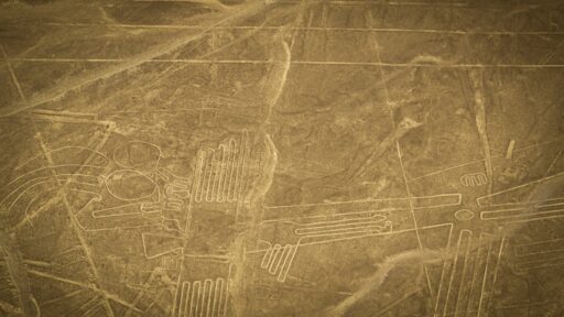
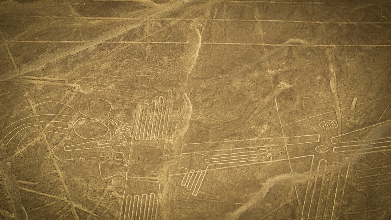
The Chicama Valley, north of Trujillo, has long been known for its pre-Columbian sites, but recent fieldwork has focused attention on a large geoglyph carved into the desert slope. Researchers describe a monumental earth design that uses cleared stone and contrasting soil to create a figure visible from surrounding hills. Project reports state that the geoglyph stretches across a broad hillside and appears to have been carefully aligned with local topography rather than laid out on a flat plain.
What transforms this discovery from an isolated artwork into a landscape project is the adjacent agricultural zone. Survey teams mapped a network of canals, reservoirs and rectilinear plots that together cover about 100 hectares beside the geoglyph. The features include long feeder channels that tap seasonal runoff, smaller distribution ditches and leveled fields that would have supported intensive cultivation in a region that today receives very little rainfall.
Excavations have identified stone-lined canals with plastered interiors that helped reduce seepage and control flow. In several sectors, archaeologists recorded superimposed irrigation features, which suggests repeated remodeling of the system over generations. The pattern indicates a planned complex rather than ad hoc garden plots. One report on the Chicama geoglyph notes that the agricultural zone appears to have been laid out in relation to the earthwork itself, with some canals running parallel to its main axis.
Alongside the irrigation structures, teams documented low terrace walls that stabilized slopes and expanded cultivable land. Soil samples from these terraces show repeated episodes of cultivation and fallow, pointing to a long-lived farming regime. Ceramic fragments recovered from canal fills and nearby habitation spots link the complex to pre-Inca coastal cultures that flourished in the valley.
How the Chicama complex changes the story of coastal agriculture
The combination of a monumental geoglyph with a large-scale irrigation system forces a rethinking of how ancient communities in the Chicama Valley organized their labor and ritual life. Instead of treating the geoglyph as a purely ceremonial or artistic expression, the new work situates it inside a managed agricultural landscape that would have demanded constant upkeep. Maintaining canals, cleaning intakes and repairing terrace walls all required coordinated work parties and some form of leadership capable of mobilizing people at the valley scale.
Archaeologists involved in the broader survey describe several monumental discoveries in the valley, including additional geoglyphs, platform mounds and irrigation works that together outline a dense cultural corridor along the river. The report on these monumental discoveries emphasizes how closely ceremonial structures are tied to water management features. Within that context, the 100 hectare farming zone beside the main geoglyph looks less like a backdrop and more like a central part of the project.
This pattern echoes what has been documented in other Peruvian valleys, where irrigation canals, temples and elite residences form integrated complexes. At Chicama, the direct physical link between the giant earth figure and the irrigated fields suggests an ideology in which agricultural fertility, social identity and sacred imagery were inseparable. The geoglyph may have marked the community that controlled the canals, signaled rights to water or served as a focal point for rituals timed to planting and harvest cycles.
The scale of the agricultural complex also has implications for population estimates. A 100 hectare irrigated tract, if farmed intensively with coastal staples such as maize, beans and gourds, could have supported a sizeable community clustered along the canal lines. The density of ceramics and domestic debris near the waterworks supports the idea of multiple small settlements tied together by shared infrastructure and ceremonial spaces, rather than a single dominant urban center.
Why the 100-hectare farming complex matters for Peru and beyond
The Chicama findings matter now because they sharpen debates about how early Andean societies achieved social complexity in marginal environments. The valley lies on the Pacific coastal strip, where rainfall is scarce and agriculture depends on diverting river water onto desert soils. The newly documented irrigation system shows that local communities were not simply responding to environmental constraints in a piecemeal way. They were planning large, interconnected projects that required engineering knowledge and long-term coordination.
For Peruvian heritage management, the recognition of a 100 hectare agricultural complex beside a highly visible geoglyph raises new challenges. Geoglyphs attract attention from tourists and looters, but irrigation canals and field systems can be harder to recognize and protect. Modern expansion of sugarcane, avocado orchards and road networks in coastal valleys often erases low-relief archaeological features. Without clear mapping and legal protection, the very infrastructure that sustained ancient communities risks being plowed under while the dramatic earth figure survives as an isolated monument.
The discoveries also feed into a wider scientific conversation about climate variability and resilience. Coastal Peru has always faced irregular rainfall linked to Pacific conditions, and ancient irrigation systems had to cope with floods, droughts and shifting river channels. The repeated remodeling seen in the Chicama canals suggests that farmers adjusted their infrastructure in response to changing water supplies. Studying how they managed these shifts can inform present-day efforts to adapt irrigation schemes to new climate realities along the same river systems.
There is also a cultural dimension that reaches beyond academic circles. For local communities in the Chicama Valley, the recognition of a sophisticated ancient farming complex reinforces long-standing claims to deep historical ties with the land and water. It supports educational initiatives that present the valley not just as a backdrop for distant empires, but as a place where local innovators developed their own solutions to environmental and social challenges. That narrative can strengthen community-led stewardship of both the geoglyph and the less visible agricultural remains.
Future research and protection for the Chicama Valley landscape
The next steps for Chicama will likely focus on refining the chronology of the geoglyph and its associated fields. Targeted excavations at canal junctions, terrace walls and habitation areas can provide radiocarbon dates that clarify whether the irrigation system and the earth figure were built at the same time or in successive phases. Microscopic analysis of sediments from canal beds may reveal changes in water flow and maintenance, while botanical remains from field soils can identify specific crops and planting strategies.
Remote sensing is set to play a larger role. High resolution satellite imagery, drone-based photogrammetry and ground penetrating radar can help map subtle features across the 100 hectare zone and beyond. These tools are especially useful in a valley where modern agriculture and construction have already obscured parts of the archaeological record. By building a detailed digital model of the ancient landscape, researchers can test hypotheses about how water moved through the system and how field layouts related to the geoglyph and nearby ceremonial structures.
On the preservation side, regional authorities and heritage agencies face the task of integrating the newly mapped agricultural complex into existing protection frameworks. That may involve extending site boundaries, negotiating with landowners and coordinating with irrigation boards that manage contemporary water rights. Clear signage, community workshops and school programs can help local residents recognize ancient canals and terraces as heritage assets rather than obstacles to modern land use.