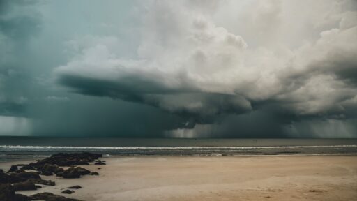


Tropical Storm Arthur became the first named storm of the 2026 Atlantic hurricane season before moving ashore along the Texas Gulf Coast and bringing a serious flash-flood threat to several southern states.
Arthur formed close to the middle Texas coast on Wednesday, June 17, with maximum sustained winds of approximately 45 miles per hour. The compact and poorly organized storm moved inland over Matagorda County before its circulation appeared to reform farther northeast near Galveston. It weakened into a post-tropical system by early June 18, but its moisture continued moving across the southeastern United States.
The storm was relatively weak in terms of wind speed and spent only a short time as a named tropical cyclone. Its greatest danger came from exceptionally heavy rainfall rather than destructive hurricane-force winds.
Arthur Developed Very Close to the Texas Coast
Arthur had limited time to strengthen because it formed near land rather than over the open tropical Atlantic.
The National Hurricane Center began issuing advisories as the system organized over the northwestern Gulf. By midday on June 17, it had developed sufficient circulation and sustained winds to receive the name Arthur, making it the first storm of the 2026 Atlantic season.
At its strongest, Arthur produced sustained winds of about 45 miles per hour, equivalent to 40 knots. Its minimum central pressure was estimated at approximately 999 millibars. The storm remained a tropical cyclone from June 17 to June 18.
Because Arthur formed so close to the shoreline, communities had little time between the storm’s naming and the arrival of its strongest conditions. This kind of rapid, near-coast development can make preparation more difficult even when the storm does not become a hurricane.
Official advisories and historical storm information are available through the National Hurricane Center.
The Center Moved Inland Before Reforming Near Galveston
Satellite images and surface observations indicated that Arthur’s original circulation moved inland over Matagorda County during the afternoon of June 17.
The storm’s structure was not stable, however. Its center later appeared to reform farther northeast close to Galveston as strong thunderstorms continued over the upper Texas coast. A National Hurricane Center analysis placed Arthur approximately 10 nautical miles northwest of Galveston during the evening, with tropical-storm-force winds still occurring within the system.
This complicated structure explains why some reports described Arthur as making landfall near Galveston, while official discussions also identified the earlier center crossing in Matagorda County.
Arthur quickly weakened as its circulation interacted with land and encountered strong wind shear. By Wednesday night, the storm had lost its organized tropical structure and opened into a low-pressure trough.
Heavy Rain Was Arthur’s Biggest Threat
Although Arthur was not a powerful windstorm, it carried a large amount of tropical moisture.
Forecasters warned that the system could produce widespread rainfall totals of 5 to 10 inches from the middle and upper Texas coast through parts of Louisiana, Mississippi and Alabama. Western Georgia and the Florida Panhandle were also included in the broader rainfall threat.
Some locations were forecast to receive isolated totals approaching 20 inches. Rainfall of that intensity can overwhelm drainage systems, rapidly flood roads and cause streams and rivers to rise.
The National Hurricane Center repeatedly warned that Arthur and its remnants could create dangerous or life-threatening flash flooding even after the storm lost its tropical classification.
This distinction is important because a storm does not stop being dangerous when it weakens below tropical-storm strength. Moisture can continue producing destructive rainfall long after the winds decrease and the circulation becomes less organized.
Flooding Continued After Arthur Weakened
Arthur’s remnants were expected to move from southeastern Texas into western Louisiana before crossing portions of the Southeast through Friday.
Emergency preparations included clearing drainage systems, placing flood barricades and distributing sandbags in vulnerable communities. Authorities in Louisiana and Mississippi prepared for repeated rounds of rain that could fall over already saturated areas.
A state of emergency was declared in Picayune, Mississippi, following intense rainfall. New Orleans officials positioned equipment and boats in case streets flooded and residents required assistance.
The storm also generated a risk of isolated tornadoes, particularly in areas located east of its center. Tropical systems can create short-lived tornadoes when bands of thunderstorms interact with changing wind speeds and directions near the ground.
Coastal Communities Faced Storm Surge and Dangerous Surf
Arthur’s winds pushed Gulf water toward portions of the Texas and Louisiana coast.
Forecasts indicated the possibility of water levels rising approximately 2 to 4 feet above normally dry ground in some coastal areas between Port Bolivar, Texas, and Morgan City, Louisiana. The highest water was expected near and east of the location where the center crossed the coastline.
Even after coastal warnings were discontinued, elevated water levels, rough surf and rip currents remained possible along the northwestern Gulf Coast.
Rip currents can pull swimmers away from shore even when weather conditions appear to be improving. The National Hurricane Center warned that Arthur-generated swells could create life-threatening surf conditions for another day or two after the storm weakened.
Residents and visitors should rely on instructions from local beach patrols and National Weather Service offices rather than judging water safety only by the appearance of the waves.
Arthur Caused Limited Wind Damage but Serious Disruption
Arthur’s wind speeds were much lower than those of a hurricane, which begins at sustained winds of 74 miles per hour.
Tropical-storm-force gusts were still capable of breaking weak tree limbs, damaging unsecured outdoor objects and causing scattered power outages. Coastal communities also faced travel disruption from flooded roads and reduced visibility during heavy downpours.
The storm moved through an area containing major energy infrastructure, including oil refineries, liquefied natural gas facilities and offshore platforms. Companies monitored conditions and implemented precautionary measures, although major long-term disruptions were not initially expected.
Arthur demonstrated that a weak tropical storm can still create widespread consequences when it develops close to a populated coastline and carries enough moisture to produce extreme rainfall.
The First Named Storm Arrived Early in the Season
The official Atlantic hurricane season runs from June 1 through November 30, with activity usually reaching its highest levels between August and October.
Arthur formed on June 17, relatively early in the season. Early development in the Gulf is not unprecedented because waters near the coastline can become warm enough to support tropical systems before conditions across the central Atlantic become favorable.
NOAA had forecast a below-normal 2026 Atlantic season, with approximately 8 to 14 named storms, 3 to 6 hurricanes and 1 to 3 major hurricanes. The outlook was strongly influenced by the anticipated development of El Niño, which commonly produces upper-level winds that disrupt Atlantic storms.
A below-normal forecast does not mean coastal areas are safe. Seasonal predictions describe overall activity across the entire Atlantic basin and cannot determine exactly where individual storms will form or make landfall.
Arthur showed how even a quiet season can begin with a system capable of producing life-threatening weather.
Why Slow-Moving Tropical Rain Is So Dangerous
Rainfall damage depends on more than the storm’s official category.
A rapidly moving hurricane may cross an area before depositing extreme rainfall, while a weak tropical storm can cause catastrophic flooding if it moves slowly or sends repeated bands of rain over the same communities.
Urban areas are especially vulnerable because roads, parking lots and buildings prevent water from soaking naturally into the ground. Drainage systems may become overwhelmed within minutes when rain falls faster than it can be removed.
Drivers frequently underestimate the depth or strength of moving floodwater. A flooded road can conceal washed-out pavement, debris or currents strong enough to move a vehicle.
The National Weather Service flood-safety resource advises people never to walk, swim or drive through floodwater. Turning around and choosing another route is safer than attempting to cross an uncertain flooded area.
Residents Should Remain Alert After Landfall
The landfall of a tropical storm does not mark the end of the emergency.
Rain bands may continue for many hours, and flooding can worsen downstream after the heaviest rain has stopped. Rivers and drainage channels may take time to respond as water moves through the watershed.
Residents should keep emergency alerts enabled, avoid unnecessary travel and follow evacuation or shelter instructions from local authorities. People living near rivers, bayous and low-lying roads should be especially cautious.
Generators must be used outdoors and well away from doors, windows and vents. Operating a generator inside a garage, even with the door open, can allow deadly carbon monoxide to accumulate inside the home.
Anyone who encounters a downed power line should remain well away from it and report it to emergency services or the local utility company.
What Arthur Means for the Rest of the Season
Arthur was a short-lived tropical storm rather than a major hurricane. Its development nevertheless provided an early reminder that coastal risks are not determined solely by a storm’s category.
The system formed close to Texas, reached tropical-storm strength, crossed the coastline and weakened in roughly a day. During that short period, it generated threats from flash flooding, storm surge, dangerous surf and isolated tornadoes across a wide region.
Residents along the Atlantic and Gulf coasts should use the early-season storm as an opportunity to review emergency supplies, evacuation routes, insurance documents and communication plans.
Arthur may have been the season’s first named storm, but hurricane preparedness must continue through the end of November.