Far beneath the surface of a Great Lakes shipping lane, archaeologists have mapped a stone-built hunting landscape laid out roughly 9,000 years ago, when the water was frozen and caribou moved across the exposed ground. What now appears as a flat, cold-blue expanse once held dry tundra, human camps, and carefully positioned rock walls that funneled animals into kill zones. The discovery is reshaping how researchers understand early life in the Great Lakes basin and how much of that story now lies underwater.
The submerged site reveals a level of planning, cooperation, and environmental knowledge that rivals far better known ancient monuments on land. It also underscores how quickly a familiar landscape can vanish beneath rising water, leaving only traces for future scientists to find.
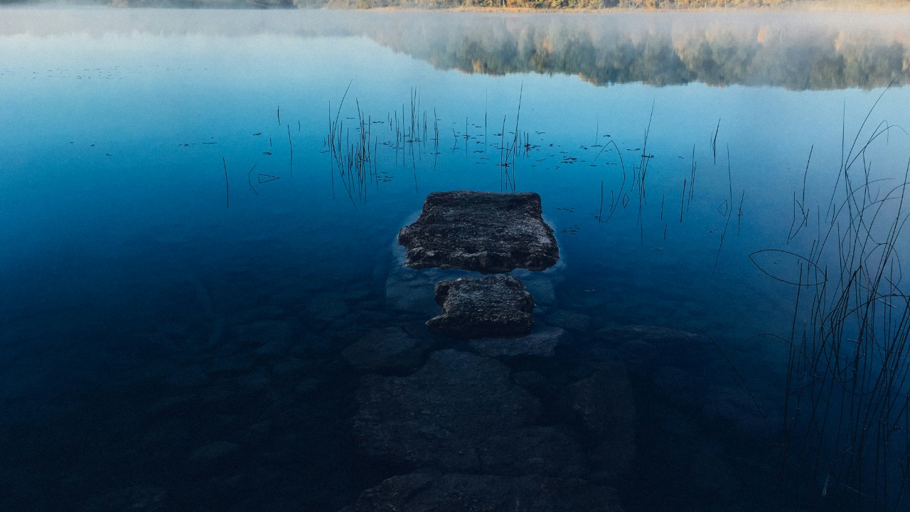
How a vanished land bridge became a mapped hunting ground
The stone structures sit on the Alpena Amberley Ridge, a limestone highland that once formed a dry corridor between what are now Michigan and Ontario. During the last Ice Age, when water levels were lower and glaciers still retreated to the north, this ridge was an open, windswept land bridge that caribou used as a seasonal migration route. Archaeologists working with sonar, underwater photography, and scuba surveys have shown that this ridge now preserves a network of Ice Age hunting arranged along that ancient path.
Researchers from the University of Michigan and partner institutions documented low stone walls, stacked rock features, and circular arrangements that match known caribou drive systems in the Arctic. One set of alignments appears to have been designed for the animals’ spring migration, when herds moved in smaller groups and could be steered into tight lanes. Another set seems better suited to the larger, more concentrated movements of the fall season, suggesting that hunters returned to the ridge at different times of year and adapted their tactics accordingly.
Mapping this landscape has required a combination of high resolution sonar, underwater drones, and diver verification. The structures lie in relatively shallow water, which protects them from the heavy sediment that buries deeper sites. Their preservation is so good that archaeologists can trace individual stones and reconstruct how hunters would have moved across the ridge, where they likely hid, and how they might have coordinated to close off escape routes for the caribou.
Evidence from chipped stone tools and the layout of the features points to a date of roughly 9,000 years before present, when the climate had warmed but the Great Lakes had not yet filled to their modern levels. That timing places the site in a key transitional period, when people in the region were shifting from strictly Ice Age conditions into the forests and lakes that would define later Indigenous cultures.
What new research reveals about ancient Great Lakes hunters
The submerged hunting complex challenges older assumptions that early Great Lakes societies were small, loosely organized bands that followed game opportunistically. Instead, the design of the rock walls and blinds suggests planned, cooperative hunts that required shared knowledge of animal behavior and the landscape. University of Michigan investigators have emphasized how the ridge functioned as a predictable choke point, a place where herds had to pass and where people could gain an advantage by reshaping the ground with stone. Their work on this 9,000 year old shows that the builders anticipated caribou movements at the scale of kilometers, not just a single kill spot.
Archaeologists compare the planning behind these structures to caribou drives documented among Inuit and other Arctic communities. In both cases, hunters used low walls and natural ridges to guide animals toward ambush points, often coordinating across wide areas. The Alpena Amberley Ridge appears to preserve that same strategy, frozen in place on the lake bottom. The similarity suggests that people separated by thousands of years and great distances converged on comparable solutions when facing the same kind of prey and terrain.
The underwater site also fits into a broader pattern of ancient architecture in the Great Lakes region. Off another part of the Michigan shoreline, divers and researchers have described a ring of stones and associated carvings that have been likened to a small-scale Stonehenge. That feature, promoted in popular accounts as a 9,000 year old, remains debated among specialists, but it has helped draw public attention to the idea that significant prehistoric structures can survive on the lake floor.
Further afield, writers have highlighted a possible 10,000 year chronology for stone alignments under Lake Michigan, presenting them as part of a wider story of early monument building and ritual life in the basin. Some of these interpretations, such as those describing a 10,000 year old, remain more speculative than the clearly functional caribou drive lanes on the Alpena Amberley Ridge. Together, however, they reinforce the idea that submerged landscapes can hold both practical hunting structures and features that may have had symbolic or ceremonial roles.
What sets the Lake Huron hunting complex apart is the combination of clear function, fine grained mapping, and its secure placement in a known migration corridor. It gives researchers a rare, almost cinematic view of how early Great Lakes hunters organized their lives around seasonal movements of game and the changing shape of the land.
Why a 9,000 year old caribou drive matters in the present
The discovery carries weight beyond regional archaeology. It expands the record of human adaptation to climate change. The people who built these walls lived through a period when ice sheets retreated, shorelines shifted, and the Great Lakes rose to flood their former hunting grounds. Their decision to invest labor in stone structures on the Alpena Amberley Ridge shows how they used detailed knowledge of animal behavior to sustain themselves in a transforming environment. For scientists studying how communities respond to rapid ecological change, this underwater site offers a long term case study.
It also demonstrates the importance of submerged cultural heritage. Globally, archaeologists estimate that large portions of early coastal and lakeshore settlements now lie underwater, drowned by post glacial sea level rise. The Alpena Amberley Ridge provides a proof of concept that such sites can be found and studied in detail, even in cold, often rough inland waters. The techniques refined here, from sonar survey to diver mapping, can be applied to other drowned landscapes that may hold early evidence of human activity.
The site further shapes how the public imagines ancient North American societies. Popular fascination with stone monuments often gravitates to places like Stonehenge or Göbekli Tepe, but the Great Lakes discoveries show that complex, planned stone features also exist in what many people still assume was an untouched wilderness. Reports on the submerged hunting structures highlight how these builders engineered their environment in subtle ways, using low walls and natural ridges rather than towering megaliths.
For Indigenous communities with deep ties to the region, the underwater ridge represents part of an ancestral landscape that did not vanish when the water rose. It offers material confirmation that people lived, hunted, and likely held stories about places that now sit beneath the lake. Collaborative research and consultation can help connect the scientific findings with oral histories and cultural knowledge that extend across millennia.
Future research and protection for a hidden Ice Age landscape
Archaeologists see the Alpena Amberley Ridge as only one piece of a much larger submerged world. As survey technology improves, they expect to find additional hunting structures, campsites, and perhaps waterlogged artifacts such as wooden tools or preserved plant remains. Each new feature will help refine the picture of how early Great Lakes hunters organized their year, from spring caribou drives to other seasonal activities on what is now the lake floor.