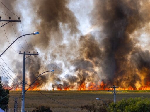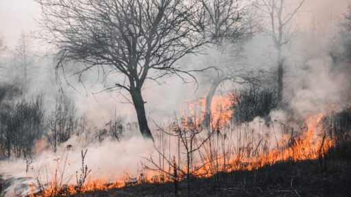
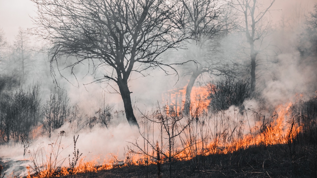

Wind-driven flames on the Umatilla Indian Reservation in northeastern Oregon have burned close to 5,000 acres, forcing evacuation concerns, drawing hundreds of firefighters, and highlighting how quickly grass, brush, and timber fires can grow when hot, dry weather meets strong wind.
The fire, known as the North Cayuse Fire, started on July 4, 2026, about six miles east of Mission, Oregon. By July 10, officials reported it had grown to 4,887 acres and was 27% contained, according to local fire updates shared by regional media. By July 12, the same acreage was still being reported, while containment had improved sharply to 91%, with about 110 personnel still assigned.
The fire did not become one of the largest fires in Oregon history, but its speed, location, and timing made it serious. It burned on tribal land, threatened homes and natural resources, and required coordinated response from tribal emergency management, state fire agencies, and incident management teams.
Where the Fire Burned
The North Cayuse Fire burned on the Confederated Tribes of the Umatilla Indian Reservation, near Mission and east of Pendleton. The Umatilla Indian Reservation is home to the Confederated Tribes of the Umatilla Indian Reservation, made up of the Cayuse, Umatilla, and Walla Walla peoples. The reservation lies in northeastern Oregon, mostly in Umatilla County, with tribal headquarters near Mission.
That location matters because a wildfire on reservation land is not only a fire-management event. It can affect homes, roads, grazing land, cultural resources, traditional-use areas, wildlife habitat, watersheds, and community infrastructure.
For the CTUIR community, fire response is not just about protecting acres. It is about protecting a living homeland.
Why Wind Made the Fire So Dangerous
Wildfire behavior can change dramatically when wind increases. Wind pushes flames forward, dries fuels, carries embers ahead of the main fire, and can make fire lines harder to hold. In grass and brush, wind can turn a small ignition into a fast-running fire in minutes.
The National Interagency Coordination Center’s July 13 situation report described extreme fire behavior on related regional incidents, including wind-driven runs, spotting, torching, and threats to infrastructure. While regional reports often cover multiple fires, the same ingredients explain why eastern Oregon fires can spread so quickly when wind aligns with dry fuels.
Wind does not need to blow at hurricane strength to create danger. Even moderate wind can carry embers into new fuel beds and force crews to shift from direct attack to structure protection, flanking work, and holding control lines.
The Fire Grew Quickly After Ignition
Early reports showed the North Cayuse Fire expanding rapidly after its July 4 start. The East Oregonian reported on July 6 that the fire had already reached roughly 2,300 to 2,500 acres. That early growth showed how quickly conditions allowed the fire to move through grass, brush, and timber.
By July 9, updates placed the fire near 4,885 acres and 15% containment. By July 10, it was listed at 4,887 acres and 27% containment. The acreage then appeared to stabilize, and containment rose to 91% by July 12.
That progression tells an important story. The fire made its major run early, then crews gradually built and strengthened containment around the perimeter.
What Containment Means
Containment does not mean a fire is out. It means firefighters have built or used control lines around part of the fire perimeter that they believe can stop further spread under expected conditions.
A fire can be 91% contained and still have hot spots, smoke, smoldering logs, heat inside the perimeter, and areas needing patrol. Crews may continue mop-up for days or longer, especially where winds could test lines again.
In the North Cayuse Fire, officials reported that hot spots inside the perimeter were still producing smoke, but they were not expected to move beyond control lines in later updates. That is exactly what containment is meant to do: keep remaining heat from becoming a new escape.
Evacuations Were Ordered and Then Downgraded
The fire triggered evacuation action on the reservation. KPTV reported that officials issued “Go Now” orders for people east of the fire, including areas around Buckaroo Lane to Iskuulpa, before later downgrading evacuation levels after the fire was no longer threatening homes as directly.
That downgrade was good news, but the initial evacuation shows how close the fire came to becoming a direct residential threat. Wildfire evacuations can happen quickly, especially when wind-driven flames move through dry vegetation.
For residents, the lesson is clear: evacuation levels matter. A Level 1 notice means be ready. A Level 2 notice means be set to leave. A Level 3 notice means go now. Waiting too long can leave people trapped by smoke, closed roads, or fast-moving flames.
Firefighters Focused on Holding Lines
As containment improved, crews focused on patrol and line work near areas such as Iskuulpa Creek and Red Elk Canyon, according to NBC Right Now’s July 10 update. The report said smoke was still visible from hot spots inside the perimeter, but those areas were not expected to move past control lines.
That kind of work is less dramatic than flames racing up a slope, but it is critical. Fires are often lost during wind shifts, hot afternoons, or when interior heat finds an unburned pocket near the edge. Crews must find heat, cool it, strengthen lines, remove fuels, and keep watch.
Mop-up and patrol are the difference between a contained fire and a fire that escapes again.
Aircraft Needed Protected Airspace
A Temporary Flight Restriction was placed around the North Cayuse Fire, according to East Oregonian reporting. The restriction covered a five-mile area to keep aircraft safe as they maneuvered around the incident.
Temporary Flight Restrictions matter because firefighting aircraft operate at low altitude, often in smoky, turbulent, difficult conditions. Helicopters and air tankers may dip water, drop retardant, scout fire behavior, move supplies, or help firefighters understand the perimeter.
Unauthorized drones are a serious hazard. If a drone enters restricted airspace, firefighting aircraft may be grounded. That can put firefighters and communities at greater risk.
Why Grass and Brush Fires Move So Fast
Grass and brush ignite easily and spread quickly. Fine fuels dry faster than large logs or heavy timber, so they can become fire-ready soon after hot, windy conditions arrive. Once ignited, flames can run across open ground faster than people expect.
That is why a fire in grassland or shrub-steppe can cover thousands of acres quickly even if it does not burn through dense forest. The flames may be shorter than a crown fire, but the forward spread can be intense.
On the Umatilla reservation and surrounding parts of eastern Oregon, grass, brush, timber edges, canyons, and wind can combine into complicated fire behavior. Firefighters may face fast grass runs in one area and heavier fuels in another.
Why the Reservation Context Matters
Wildfire on tribal land carries additional layers of meaning. The Confederated Tribes of the Umatilla Indian Reservation manage lands tied to culture, treaty rights, natural resources, food systems, water, wildlife, and community life. A burned landscape can affect more than buildings.
Fire can damage traditional gathering areas, grazing ground, riparian zones, fencing, roads, burial or cultural sites, fish and wildlife habitat, and scenic or recreational areas. Smoke can affect elders, children, and people with asthma or heart disease.
At the same time, fire is also part of many western ecosystems, and Indigenous fire knowledge has long recognized the role of carefully managed burning. The danger comes when fire arrives under extreme wind, drought, heat, and modern fuel conditions, moving too fast for safe control.
Smoke Was Another Health Concern
Even when flames do not reach homes, smoke can create serious health risk. Wildfire smoke contains fine particles that can enter the lungs and bloodstream. It can worsen asthma, chronic obstructive pulmonary disease, heart disease, and other conditions.
The CDC warns that wildfire smoke can make anyone sick, but children, older adults, pregnant people, outdoor workers, and people with heart or lung disease face higher risk. During active fire periods, residents should monitor air quality, keep indoor air cleaner, close windows when smoke is heavy, use filtered air when possible, and reduce outdoor exertion.
Smoke can travel beyond the fire perimeter. A community does not need to be in the flames to feel the health impact.
Why Fire Season Is Becoming More Stressful
Western fire seasons are increasingly shaped by heat, drought, dry fuels, wind events, and longer periods of fire-prone weather. Climate change does not start every wildfire, but it can make landscapes more receptive to fire by drying vegetation and intensifying heat.
Research on wildfire smoke and burned area in the western United States has found that anthropogenic climate change has contributed substantially to fire emissions and smoke exposure across many regions over recent decades.
For Oregon communities, that means fire planning can no longer be treated as a short seasonal concern. Preparedness, defensible space, evacuation planning, smoke protection, and resilient infrastructure are becoming year-round needs.
What Residents Should Do During Nearby Wildfires
People living near a wildfire should follow official evacuation guidance, not rumors or social media speculation. They should keep vehicles fueled, pack essential medicines, documents, pet supplies, chargers, clothes, water, masks, and important contacts.
Homes should have defensible space where possible. That means clearing dry leaves, needles, and flammable debris from roofs, gutters, decks, and around structures. Firewood, propane tanks, outdoor furniture, and other combustible materials should be moved away from buildings during high fire danger.
Residents should also sign up for local emergency alerts. Wildfires can shift fast, and official alerts may provide the difference between leaving safely and leaving too late.
Why Road Closures Matter
Road closures during wildfires can frustrate residents, but they are often necessary. Roads may be blocked by flames, smoke, downed trees, firefighting equipment, hose lines, utility crews, or evacuation traffic. Reopening too early can put both residents and firefighters in danger.
People should never drive around barricades or enter closed fire areas. A road that looks safe at one moment can become dangerous if wind shifts or smoke thickens.
Closures also help crews work efficiently. Fire engines, water tenders, dozers, and aircraft support vehicles need room to move without civilian traffic.
Why Livestock and Pets Need Early Planning
Wildfires can move too quickly for last-minute animal evacuation. Rural and reservation communities often have livestock, horses, dogs, cats, and working animals that require planning.
Animal owners should identify trailers, holding areas, backup feed, water, identification, and evacuation destinations before fire reaches the area. Pets should have carriers, leashes, medication, and food ready.
During fast fire growth, emergency managers may not have time to help move animals. Early action is often the safest option.
Why Firefighters Still Work After the Headlines Fade
Public attention often fades once acreage stops growing, but firefighters may keep working for days or weeks. They patrol lines, extinguish hot spots, repair suppression damage, remove hazard trees, monitor weather, and prepare for wind shifts.
The North Cayuse Fire’s jump to 91% containment by July 12 was a strong sign of progress, but it did not mean the incident instantly disappeared. Fires can retain heat in stumps, roots, logs, and duff. A gusty day can expose weak spots.
This quieter phase is essential to prevent a second run.
Why Full Suppression Can Leave Repair Work Behind
After fire containment, crews may begin suppression repair. Fire lines, dozer paths, staging areas, and access routes can disturb soil and vegetation. Repair work may include water bars, erosion control, road cleanup, fence repair, and rehabilitation of disturbed areas.
On tribal lands, repair work can also include special attention to cultural and natural resource concerns. Burned-area recovery is not only about stopping flames. It is about helping the land recover safely.
Heavy rain after wildfire can create erosion, debris flows, and water-quality problems, especially on steep or heavily burned slopes. That makes post-fire planning important.
Why The Fire Was a Warning Even Without Catastrophic Losses
The North Cayuse Fire appears to have avoided the worst-case outcome of widespread home loss, but it still served as a warning. It showed how quickly a July 4 ignition could expand to thousands of acres under wind-driven conditions.
A fire does not need to destroy a town to be serious. It can threaten homes, force evacuations, close roads, strain emergency services, damage resources, and expose residents to smoke.
For communities across the inland Northwest, the message is clear. Hot, dry, windy conditions can turn a small start into a major incident before most people have time to react.
What Comes Next for the North Cayuse Fire
With the fire holding at about 4,887 acres and containment reported at 91% by July 12, the focus shifted toward patrol, mop-up, and ensuring fire lines remained secure. Crews were reduced as the threat decreased, but officials continued monitoring hot spots and fire behavior.
Residents should continue following CTUIR Emergency Management, local fire agencies, and county alerts for changes. Fire conditions can change with wind, heat, low humidity, or new lightning.
The main fire may be nearly contained, but fire season is not over.
Final Takeaway
The North Cayuse Fire on Oregon’s Umatilla Indian Reservation started July 4, 2026, about six miles east of Mission and burned close to 5,000 acres. By July 10, it was reported at 4,887 acres and 27% contained; by July 12, containment had improved to 91% while acreage remained about the same.
The fire forced evacuation orders, required a multi-agency response, and showed how wind-driven flames can rapidly spread through grass, brush, and timber in northeastern Oregon. Hot spots and smoke remained inside the perimeter even after containment improved.
The practical lesson is simple. During fire season, residents near wildland areas should stay alert, follow evacuation levels, prepare go-bags, protect indoor air from smoke, avoid restricted fire areas, and never interfere with firefighting aircraft. A fire that starts on a holiday afternoon can become a landscape-scale emergency before nightfall.