
China has issued fresh alerts for rainstorms and severe convective weather as repeated downpours increase the risk of flooding, landslides and urban disruption across several regions.
The latest warnings arrive during the country’s most dangerous flood-control period, when warm, moisture-heavy air can collide with changing weather systems and produce intense rainfall over a short time. The National Meteorological Center continued blue alerts for rainstorms and severe convective weather on July 19, while authorities also issued a yellow warning for geological-disaster risks.
Heavy to torrential rainfall was forecast across areas including Yunnan province, the Guangxi Zhuang Autonomous Region and Hubei province. The warnings covered more than persistent rain. Thunderstorms, hail, powerful wind gusts and localized cloudbursts could create rapidly changing conditions in areas that had already experienced weeks of severe weather.
What China’s Weather Alerts Mean
China uses color-coded warnings to communicate the expected severity of dangerous weather. For rainstorms, blue is the lowest national alert level, followed by yellow, orange and red as the expected danger increases.
A blue alert should not be interpreted as meaning there is no serious risk. It can still indicate widespread heavy rain capable of affecting roads, low-lying communities and agricultural land. Local conditions may also become much more dangerous than the national alert level suggests, particularly when storms remain over one location.
China’s official government reporting explains that the country’s four-tier rainstorm warning system places red at the highest level, followed by orange, yellow and blue. Separate warnings can be issued for severe thunderstorms, mountain torrents, floods and geological disasters, which is why several alerts may be active at the same time.
Severe convective weather refers to fast-developing storms that may contain intense rain, lightning, hail, tornadoes or damaging winds. These systems can be especially difficult to manage because their strongest effects may develop suddenly and affect a relatively narrow area.
Saturated Ground Is Increasing the Danger
The current alerts are more concerning because parts of China have already received repeated rounds of heavy rain. Once soil becomes saturated, additional water cannot easily soak into the ground. Instead, it runs downhill, enters rivers or adds pressure to unstable slopes.
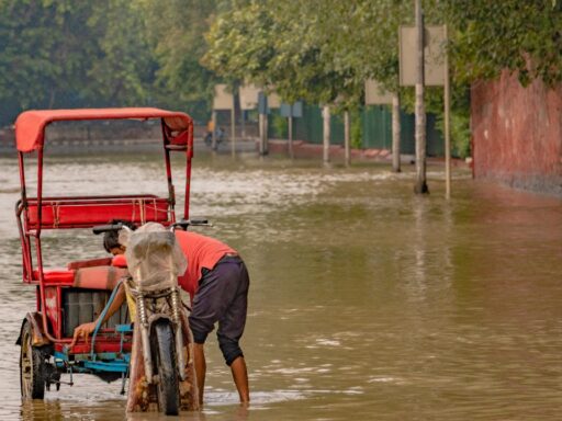
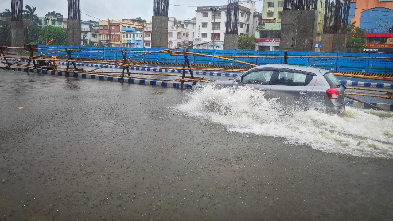
This means that a rainfall event that might normally cause limited damage can trigger a major disaster when it arrives after several wet days. Mountainous regions face particular danger from landslides, debris flows and flash floods, while cities can experience waterlogging when drainage systems receive more water than they can carry.
Authorities maintained the highest emergency response for natural-disaster relief in Guangxi after destructive flooding affected the region. Officials were instructed to strengthen monitoring of reservoirs, river embankments and flood-prone communities while preparing evacuations where necessary.
Earlier in July, extreme rainfall associated with Tropical Storm Maysak caused widespread flooding in Guangxi. At least 375,000 people were affected and approximately 130,000 were evacuated. Hundreds of reservoirs rose beyond flood-control limits, while roads, communications, electricity systems and drinking-water infrastructure were damaged.
Recent Disasters Show Why the Alerts Matter
The warnings follow a series of deadly weather-related events that have demonstrated how quickly conditions can deteriorate.
A major landslide struck Pengshui County in Chongqing on July 17 after a period of torrential rainfall. At least eight people were reported dead, while 34 remained missing in the latest widely reported figures. More than ten residential buildings were buried, and over 1,100 residents were moved away from the danger zone.
The disaster occurred in a mountainous area near the Wujiang River, where steep terrain and prolonged rain can make slopes unstable. Rescuers used heavy machinery, drones and controlled explosions to clear large rocks while monitoring the possibility of further ground movement.
Hubei province also experienced destructive thunderstorms and a rare EF2 tornado earlier in July. The storms affected approximately 14,600 people, injured more than 330 and damaged thousands of homes. The tornado lifted and displaced heavy vehicles, illustrating that China’s severe-weather risk is not limited to rainfall and flooding.
Northern China Is Entering a Higher-Risk Period
Although much of the earlier destruction occurred in southern and central China, the weather threat is increasingly shifting north.
China entered its peak flood-control period in late July, with the National Climate Centre’s outlook warning that extreme rain could become more frequent and intense through early August. Northern China, eastern Inner Mongolia and northeastern regions are expected to receive above-average precipitation.
The Beijing-Tianjin-Hebei region may receive between 20% and 50% more rainfall than usual during the critical period. Liaoning province has already recorded more than twice its typical rainfall in some locations this year.
This northward concentration matters because infrastructure, settlement patterns and emergency plans may have been designed around historical rainfall conditions. An extreme storm can overwhelm drainage systems, flood underground spaces and isolate communities even when a region has substantial flood-control infrastructure.
Typhoons Are Adding More Moisture and Uncertainty
Tropical cyclones are another major factor behind China’s difficult weather season.
The National Climate Center forecast that as many as six typhoons could form in the Northwest Pacific and South China Sea during July 2026, compared with a historical average of approximately 3.8. Up to three were expected to make landfall, and their average intensity could be stronger than usual.
Typhoons do not have to make a direct landfall over a city to create severe consequences. Their moisture can interact with other weather systems and produce prolonged rainfall hundreds of kilometres inland. Their remnants may also support tornadoes and severe thunderstorms after the original cyclone has weakened.
Tropical Storm Bavi demonstrated this wider effect. China issued warnings for rainstorms, severe convective weather and the storm itself as Bavi weakened and moved across inland regions. Mountain-flood warnings reached orange and red levels in selected areas where localized rainfall was expected to create an especially high risk.
Climate Change Is Altering the Risk
China has always experienced floods, typhoons and powerful summer storms. However, scientists warn that rising temperatures are changing where and how extreme rainfall occurs.
Warmer air can hold more moisture, creating the potential for heavier rainfall when storms develop. China’s rainfall belt is also shifting farther north and west, exposing some regions to precipitation levels that may exceed historical expectations.
Climate change is not the only factor. Rapid urban development, construction on unstable land, paved surfaces and pressure on river systems can increase the damage caused by a storm. A severe rainfall event becomes more dangerous when water has fewer natural places to drain or when homes and roads occupy flood-prone terrain.
Scientists quoted by Reuters warned that extreme events are becoming more frequent and that communities may have less time to recover before the next disaster occurs. The combination of climate conditions and dense development means adaptation must become a larger part of China’s emergency planning.
Better Forecasting Is Creating More Preparation Time
China has invested heavily in radar, satellites, forecasting models and emergency-warning systems. These improvements can give local authorities and residents additional time to act before dangerous weather arrives.
The China Meteorological Administration reported that the average warning lead time for severe convective weather increased from 38 minutes in 2020 to 48 minutes in 2025. The accuracy of 24-hour typhoon-track forecasts also improved, with the average error reduced to approximately 58 kilometres.
Ten additional minutes may appear limited, but it can allow schools to move students indoors, transport operators to suspend services and communities to leave areas threatened by flash floods or landslides. The value of a warning ultimately depends on how quickly it reaches the public and whether people understand what action to take.
China is increasingly distributing alerts through text messages, emergency broadcasts, television and digital government platforms. Authorities have also ordered expanded inspections of geological hazards and stronger coordination between meteorological, water, transport and emergency-management agencies.
The Weather Threat Is Far From Over
The renewed alerts do not represent one isolated storm. They are part of a longer sequence of severe weather affecting different parts of China during the 2026 flood season.
Rainfall may ease temporarily in one region while intensifying elsewhere. Flood danger can also remain after the clouds move away because rivers continue rising and saturated slopes may fail hours or days later.
The most immediate priorities are accurate warnings, early evacuation and careful monitoring of reservoirs, mountain communities and urban drainage systems. The broader challenge is to redesign infrastructure and emergency planning for weather conditions that may no longer follow historical patterns.
China’s repeated alerts show that the country is not simply responding to another rainy week. It is managing a period in which extreme rainfall, typhoons and severe thunderstorms can overlap, leaving communities exposed to several hazards at once.