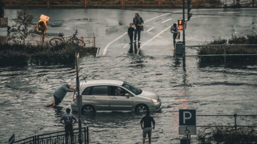
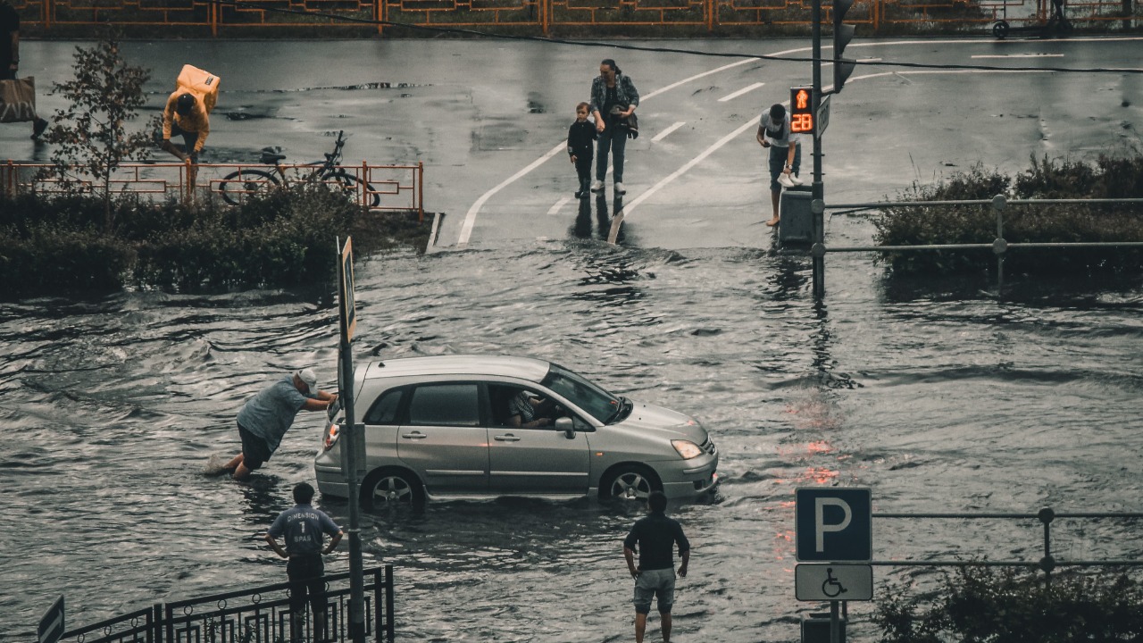

Relentless thunderstorms west of San Antonio transformed normally dry rivers and low-water crossings into violent torrents, washing over highways, isolating communities and forcing dozens of emergency rescues around Uvalde.
The first major round of flooding struck on July 14 and July 15, 2026, after some rural areas received approximately a foot of rain. Shelters opened in Uvalde and Sabinal as rescue crews pulled stranded motorists and residents from rising water. No injuries or deaths were reported during that initial phase.
Conditions deteriorated again early on July 16. Additional heavy rain inundated homes, flooded roads and forced rescuers to use boats and helicopters. Most of the rescues around Uvalde involved people trapped in vehicles. Local police initially reported no fatalities or missing people in the city.
As the wider Texas emergency developed, officials said more than 75 people had been rescued and over 100 roads had flooded or washed out across the affected region. Governor Greg Abbott deployed approximately 1,300 personnel from more than 30 agencies and declared a disaster covering 59 counties.
Uvalde Received Nearly Two Feet of Rain
Uvalde endured repeated rounds of storms over several days rather than one isolated cloudburst.
Local reporting indicated that close to two feet of rain fell in parts of the area over a couple of days. The saturated ground could no longer absorb additional water, causing new rainfall to flow rapidly into creeks, drainage channels and rivers.
In some locations, rainfall rates approached three inches per hour. Totals of 10 to 15 inches were reported since the beginning of the main event, while isolated areas received considerably more.
This combination of intense short-term rain and already saturated soil created ideal conditions for flash flooding.
A storm does not need to occur directly over a river for that river to rise. Rain falling upstream can collect across an entire watershed and move downstream as a powerful surge, sometimes reaching a community after local rainfall has slowed.
The National Weather Service Declared a Flash Flood Emergency
The National Weather Service issued flash flood warnings for Uvalde County on July 14 and later escalated the threat around Uvalde and Knippa to a flash flood emergency.
A flash flood emergency is reserved for exceptionally dangerous situations in which severe flooding poses an immediate threat to life and is already occurring or expected very soon.
Residents were repeatedly instructed to move to higher ground and avoid flooded roads.
The official National Weather Service warning page for the Austin–San Antonio region provides current alerts, river forecasts and radar information for Uvalde and surrounding counties.
Highway 90 Was Closed by Floodwater
US Highway 90, one of the most important east-west routes across South Texas, was submerged in several places.
Flooding forced the closure of portions of the highway between Uvalde and Del Rio, including sections in Kinney and Val Verde counties. Officials warned drivers not to attempt travel because water covered both directions of the road.
Highway 90 connects San Antonio with Uvalde, Del Rio and communities farther west. Closing it disrupted access for residents, emergency services and commercial traffic.
Inside and around Uvalde, bridges and smaller roads were also overtopped. The Leona River flowed across bridges and surrounding streets, cutting off normal routes through parts of the community.
A flooded highway may appear shallow from a distance, but the road underneath can be damaged, washed away or covered by fast-moving water.
More Than 100 Roads Were Flooded or Washed Out
The damage extended well beyond one highway.
By July 16, state officials said more than 100 roads had been flooded or washed out across the affected Texas counties.
Some roads were covered by water. Others suffered structural damage when fast currents eroded the soil supporting the pavement.
A washed-out road can remain dangerous after the visible water recedes. The surface may look intact while the foundation underneath has disappeared, leaving a thin layer of pavement capable of collapsing beneath a vehicle.
Transportation crews must inspect bridges, culverts and roadbeds before reopening them.
Most Rescues Involved Stranded Drivers
Emergency crews around Uvalde conducted repeated water rescues, initially using boats and later adding helicopters after daylight improved visibility.
Many of the people rescued had driven into flooded areas and become stranded when the water rose or their vehicles stopped moving.
Vehicles are particularly dangerous during flash floods.
Approximately six inches of moving water can knock an adult off balance. Around 12 inches may carry away a small vehicle, while deeper or faster water can move larger trucks and sport utility vehicles.
The force is often difficult to judge from inside a car. Drivers may also be unable to see whether the road continues beneath the water.
The National Weather Service’s flood-safety guidance emphasizes the message “Turn Around, Don’t Drown” because most flood deaths occur in vehicles.
Shelters Filled as Homes and Apartments Flooded
Flooding entered homes, businesses and apartment complexes around Uvalde.
Authorities established four shelters, including one at the Uvalde County Fairplex. That facility reached capacity as residents evacuated flooded neighborhoods.
People were evacuated from locations including the Granada Place apartment complex.
Some residents reported water entering homes or rising across roads around their properties. Emergency personnel transported people to safer areas while additional rainfall continued.
Businesses closed or reduced operations, and public services were disrupted as Uvalde became nearly gridlocked by water-covered roads.
The Leona and Nueces Rivers Rose Rapidly
The Uvalde region lies within a network of rivers, creeks and normally dry drainage channels.
The Leona River became one of the focal points of the city flooding, rising over bridges and surrounding roads.
The National Weather Service also issued flood warnings for portions of the Nueces River basin, including locations around and downstream from Uvalde.
Water from intense rainfall can concentrate rapidly in these channels, particularly where rocky or saturated ground limits absorption.
Even a stream that appears dry most of the year can become a powerful river within minutes during a flash flood.
The Wider Emergency Spread Across South and Central Texas
The flooding was not confined to Uvalde County.
Dangerous conditions developed across the Nueces and Guadalupe river basins and through parts of the Texas Hill Country.
Communities including Kerrville, Boerne, Comfort and Center Point faced additional flash flood emergencies, evacuation orders and rapidly rising rivers.
At least one person was later confirmed dead in the broader Texas flooding, while more than 70 people were rescued. The fatality was not initially reported as part of the Uvalde rescue operations.
Officials warned that the threat would continue because additional storms were moving across already saturated watersheds.
The Flood Revived Memories of the 2025 Hill Country Disaster
The July 2026 flooding occurred approximately one year after catastrophic floods devastated parts of the Texas Hill Country.
The earlier disaster killed more than 100 people, including 27 children associated with Camp Mystic. That history increased anxiety as rivers rose again and emergency alerts spread across the same broader region.
Officials and residents said preparations and warnings appeared stronger during the 2026 event.
Camps evacuated, emergency agencies pre-positioned resources and residents received repeated instructions to avoid rivers and low-water crossings.
Those measures likely helped reduce casualties, although the developing event still produced widespread destruction and at least one confirmed death.
Why Flash Flooding Happens So Quickly in This Region
South and central Texas contain steep terrain, thin soils, limestone and numerous narrow river valleys.
When intense rain falls, water can move rapidly downhill instead of soaking into the ground.
The region also contains low-water crossings where roads pass directly through stream channels. These crossings may be dry during normal weather but become impassable within minutes.
Urban development adds pavement and rooftops that direct water into drainage systems.
During a multi-day event, the risk increases because soil becomes saturated and rivers remain elevated between storms.
A rainfall amount that might have caused limited flooding on the first day can produce a much larger disaster after the watershed is already full.
A Disaster Declaration Mobilized State Resources
Governor Abbott issued a disaster declaration covering dozens of counties and activated a large multiagency response.
Approximately 1,300 personnel from more than 30 state and local agencies were deployed. Resources included search-and-rescue teams, helicopters, boats, high-profile vehicles and emergency-management personnel.
Texas Game Wardens participated in boat rescues during the initial flooding near Uvalde.
State support helps local departments when the number of flooded roads, emergency calls and isolated residents exceeds what county agencies can manage alone.
Additional Rain Could Cause New Flooding
Flood danger can continue long after the heaviest storm passes.
Rivers may keep rising as upstream runoff moves toward lower elevations. Additional thunderstorms can also redevelop over the same saturated region.
Forecasters warned that several more inches of rain were possible around Uvalde after approximately two feet had already fallen in parts of the area.
A flood watch remained in effect across a broad area that included Uvalde, Del Rio, Kerrville, Boerne and San Antonio.
Residents were advised to monitor alerts overnight because flooding is especially dangerous in darkness, when washed-out roads and moving water are difficult to see.
Drivers Should Never Cross a Barricade
A road barricade means authorities have determined that conditions are unsafe.
Driving around one places the occupants, emergency crews and other motorists at risk.
Floodwater may conceal a collapsed bridge, missing pavement, debris or a strong current.
People who encounter water across a road should turn around and find another route. When no safe route exists, they should remain in a secure location rather than attempting to reach a destination through the flood.
A vehicle trapped in rising water should be abandoned for higher ground when escape can be made safely. Anyone in immediate danger should call 911 and provide their location as precisely as possible.
Residents Should Move Before Escape Routes Close
People living near rivers, creeks and low-lying roads should not wait until water enters the home before evacuating.
Flash floods can cut off the only exit route first.
Emergency officials in other affected Texas communities warned residents to move to higher ground immediately because delaying could leave them trapped.
Essential items should be prepared in advance, including medications, identification, drinking water, phone chargers and supplies for children or pets.
Residents should follow official evacuation instructions and avoid relying only on visual conditions outside their homes.
The Main Takeaway
Flash floods west of San Antonio washed over highways, damaged roads and forced dozens of rescues around Uvalde beginning July 14, 2026.
The initial storms dropped roughly a foot of rain in some locations, while parts of the region later approached two feet over several days. Uvalde became nearly isolated as US Highway 90, local bridges and surrounding roads disappeared beneath floodwater.
Rescuers used boats and helicopters to reach people trapped in vehicles, homes and apartment complexes. No deaths or missing people were initially reported in Uvalde.
As the emergency expanded, officials reported more than 75 rescues, over 100 flooded or washed-out roads and at least one death elsewhere in the broader Texas disaster area.
The danger did not end when the rain briefly slowed. Saturated ground, elevated rivers and additional storms created the potential for renewed flooding across South Texas and the Hill Country.
The most important safety instruction remains simple: never drive through floodwater. A familiar road can become an invisible gap beneath a fast-moving current in a matter of minutes.