
A tropical wave sliding westward off the southern coast of Mexico is drawing close attention from forecasters, who see a window for it to organize into the Eastern Pacific’s next named storm by the middle of next week. With the basin already active early in the season, the disturbance is emerging over warm water and into a generally favorable environment that could support gradual development.
The system remains poorly organized and several days away from any land interaction, but its timing alongside other Pacific activity offers an early test of how this hurricane season may unfold for Mexico and, indirectly, for the United States.
Shifting signals around a new Eastern Pacific disturbance
Forecasters first focused on a broad area of unsettled weather stretching from Central America into the eastern Pacific as Tropical Storm Amanda gained strength earlier this month. Guidance from the National Hurricane Center flagged a zone south of Mexico where another tropical wave might detach from the larger gyre and consolidate into a separate low pressure area. That wave is now moving west of the Mexican coastline and entering an area of high ocean heat content that has already supported one named storm.
Amanda set the early benchmark for this pattern. It formed in the eastern Pacific and drew scrutiny because some models hinted at a path that could eventually bring remnant moisture toward Mexico and even Florida. Coverage of the system highlighted how Tropical Storm Amanda quickly organized over warm water south of Mexico, then tracked generally westward while forecasters watched for any turn toward the north.
As Amanda evolved, attention broadened to the overall pattern of disturbances in the basin, including a second area of interest flagged by hurricane specialists. Reporting on that outlook described how forecasters identified a potential development zone in the eastern Pacific, separate from Amanda’s core circulation, with a low but rising chance of tropical cyclone formation over several days.
Satellite analysis now shows that this secondary disturbance has taken on the structure of a tropical wave, with clusters of thunderstorms firing near a weak low level center. Environmental conditions are not perfect, since patches of dry air and modest wind shear linger to the north, yet the wave is moving into a corridor where those negatives may relax. That shift has led model guidance to trend toward more consistent hints of gradual organization as the system tracks away from land.
Computer models that performed reasonably well with Amanda and with an earlier Pacific storm, Boris, are again signaling slow consolidation of vorticity along the wave axis. When Tropical Storm Boris developed over the North Pacific, those same model suites depicted a similar evolution from a disorganized disturbance into a compact tropical cyclone over several days, reinforcing forecaster confidence that they can at least capture the broad trajectory of the new wave.
Why the emerging Pacific storm threat demands attention now
On its own, a tropical wave several hundred miles off Mexico might not seem especially concerning. The broader context, however, makes this disturbance more than just another blip on the satellite loop. The Eastern Pacific has already produced multiple systems early in the season, including Amanda and Boris, signaling that the basin is primed with warm water and a supportive large scale pattern.
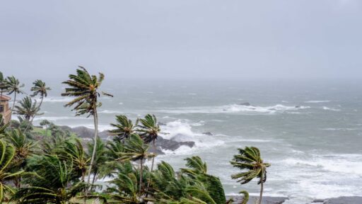
Coverage of Amanda’s formation underscored how quickly a loosely organized area of storms can spin up once it reaches that sweet spot of low shear and high sea surface temperatures. In that case, spaghetti model plots showed a tight cluster of tracks that kept the center offshore yet still brought increased swell and rip current risk to parts of Mexico’s Pacific coast. The new wave is moving through a broadly similar environment, which raises the odds of another compact storm forming on relatively short notice.
Even if the system never reaches hurricane strength, a tropical storm can still deliver hazardous impacts to shipping lanes and coastal communities. The early life of Boris provided a reminder of that reality, as Boris in the generated rough seas and required close monitoring from maritime interests despite staying well away from land. A similar scenario is plausible here if the wave consolidates over open water.
The disturbance also matters because it arrives in tandem with other Pacific features that can interact in subtle ways. Meteorologists tracking the basin have pointed out that the same broader monsoon trough that helped spawn Amanda is still active. A report on two Pacific disturbances described how overlapping gyres and waves can compete for moisture and angular momentum, sometimes limiting intensification and other times concentrating energy into a single stronger storm. The current wave is embedded in that complex background, which introduces more uncertainty into intensity forecasts.
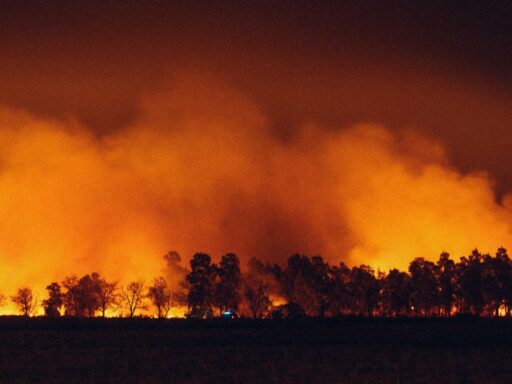
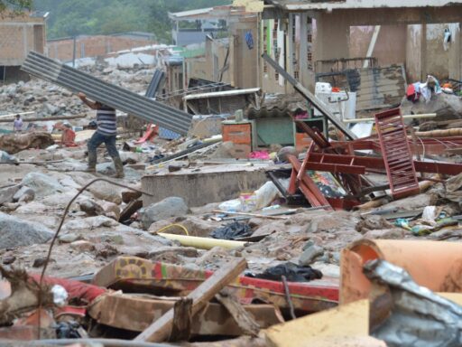
For Mexico, the main short term concern is whether the system jogs closer to the coast before turning more decisively west. Even a glancing approach could enhance rainfall along the southern and southwestern shoreline, where mountainous terrain can squeeze out heavy downpours and trigger flash flooding and landslides. Residents who remember previous seasons know that some of the most disruptive events have come from modest tropical storms that stalled or paralleled the coast rather than from headline grabbing major hurricanes.
There is also a downstream angle for the United States. Earlier outlooks for Amanda noted that even a distant Pacific storm can send moisture across Central America and into the Gulf of Mexico or Florida if the steering pattern aligns. The Florida focused forecasts around Amanda stressed that while a direct hit was unlikely, the system could still influence rain chances and surf along parts of the U.S. coastline. The new wave, if it becomes a named storm, could play a similar supporting role in shaping regional weather even without a direct approach.
How the forecast could evolve through the middle of next week
For now, the National Hurricane Center assigns the tropical wave only a modest probability of development, with the highest odds centered on the three to five day window as the disturbance moves farther from Mexico. That timeline aligns with model projections showing a gradual tightening of the surface circulation and a more coherent shield of thunderstorms once the wave reaches the central part of the Eastern Pacific.
Over the next couple of days, forecasters will watch several key signals. One is the persistence of deep convection near the wave’s center, which would indicate that the system is starting to generate its own feedback loop between surface inflow and upper level outflow. Another is the behavior of nearby disturbances within the monsoon trough. The earlier report on multiple Pacific systems emphasized that interactions can either shear apart a budding storm or help it consolidate, depending on spacing and timing.
Track guidance at this stage favors a general west to west northwest motion, which would keep the core of any eventual storm offshore. When hurricane specialists outlined the second possible system in the basin alongside Amanda, they stressed a similar steering pattern that pushed storms away from land as they intensified. Unless a stronger ridge builds over Mexico or a mid latitude trough digs unusually far south, the default expectation is that the new storm will follow that climatological route.
Intensity, however, is more sensitive to small scale changes. If vertical wind shear drops more than currently projected and the storm finds a pocket of particularly warm water, rapid intensification cannot be ruled out, although there is no clear signal for that outcome yet. Conversely, if dry air intrudes from the north or if the wave ingests too much competing vorticity from nearby disturbances, the system could remain a weak depression or open wave.
For coastal communities from Chiapas to Baja California Sur, the practical takeaway is to stay tuned to official forecasts while recognizing the current low risk of a direct strike. Even an offshore track can enhance long period swells and rip currents, a pattern that appeared during the life cycle of Boris in the, and that can catch swimmers and small boat operators off guard.