High in the eastern Andes of Peru, archaeologists are mapping the stone walls of a forgotten Inca settlement that had slipped from written history. Hundreds of buildings, terraces, and ceremonial spaces are emerging from the cloud forest, revealing a planned citadel that once anchored imperial control over a remote frontier. The work is reshaping how researchers understand Inca power far from the famous tourist circuits.
New discoveries at Ancocagua are rewriting the Inca map
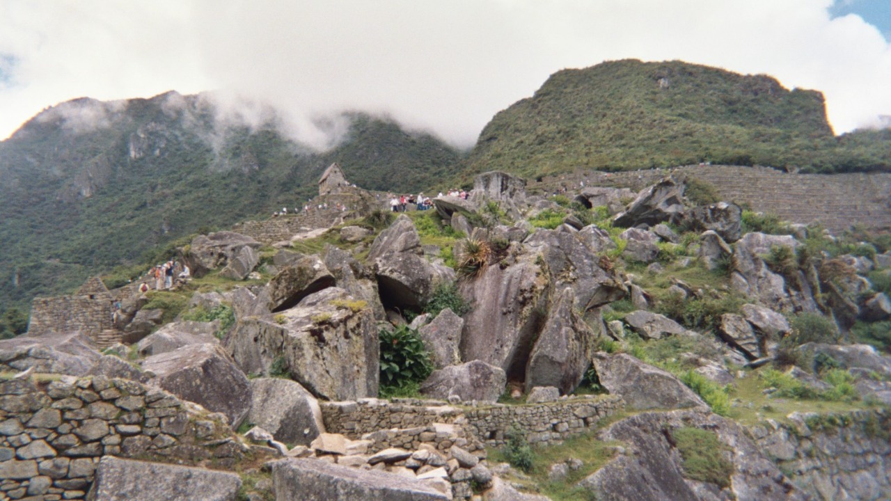
The settlement now coming into focus is Ancocagua, a sprawling complex in the Vilcabamba region where the Andes fall toward the Amazon. When archaeologists first visited the site, they described long lines of cut-stone walls vanishing into dense vegetation. Systematic mapping has since revealed a compact urban core with housing blocks, plazas, and agricultural terraces that climb the surrounding slopes.
Researchers working at Ancocagua report several hundred structures spread across the ridge, many arranged around rectangular courtyards that echo layouts at better known Inca cities. The team has identified residential compounds, storage facilities, and possible administrative buildings, all linked by narrow stone-paved paths. From the highest points, the settlement commands views over deep valleys that once carried people and goods between the highlands and the rainforest fringe.
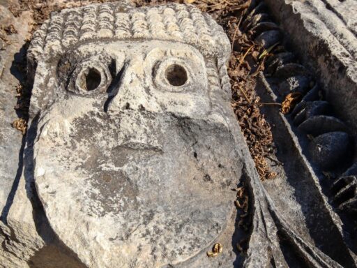
Architectural details point to a community that held more than local importance. Finely cut masonry appears in key sectors, while other areas rely on fieldstone walls, a pattern typical of sites where imperial planners invested heavily in select ceremonial or political spaces. Traces of canals and water channels suggest careful management of mountain springs, a necessity at this elevation and a hallmark of Inca engineering.
The location itself helps explain why the city grew so large. Ancocagua sits near a strategic pass that connects the high plateau with lower, warmer valleys suitable for crops like coca and tropical fruits. Archaeologists argue that the settlement likely functioned as a node on the imperial road system, where state officials could monitor traffic, collect tribute, and move troops if unrest flared in nearby regions.
From remote ruin to research focus: how the project accelerated
For decades, Ancocagua lingered on the edges of scholarship, known to local communities and a handful of explorers but largely absent from formal maps. Thick vegetation, steep terrain, and the logistical challenges of working in cloud forest kept the site out of reach for large-scale excavation. That has changed as Peruvian archaeologists, supported by regional authorities, have organized sustained field seasons focused on clearing, mapping, and stabilization.
A turning point came when researchers combined traditional survey work with drone imagery and high-precision GPS. Aerial views cut through the forest canopy, revealing rectilinear patterns that would have taken years to trace on foot. This technology-driven push showed that the settlement was not a small hilltop refuge but a full urban center, with sectors that stretch far beyond the first clusters of visible walls.
Local collaboration has also shifted the pace of work. Communities that farm and herd in the surrounding valleys have long known of stone structures hidden in the forest. Their knowledge of trails, water sources, and seasonal weather has helped archaeologists plan safer and more efficient campaigns. In turn, the project has created jobs in guiding, logistics, and conservation, giving residents a stake in protecting the ruins rather than treating them as sources of building stone or farmland.
As the scale of Ancocagua became clear, researchers began to compare its layout with other Inca centers across the Vilcabamba region. Patterns in the orientation of buildings, the placement of plazas, and the distribution of storage facilities suggest coordination with nearby sites that guarded other passes and valleys. That networked perspective has turned Ancocagua from an isolated curiosity into a key piece of a broader imperial strategy.
Why a lost Inca citadel matters for the present
The emerging picture of Ancocagua has implications that reach beyond academic debates about Inca administration. The site offers a rare, relatively undisturbed example of how a highland empire managed the transition from cold, steep slopes to humid lowlands. Agricultural terraces that ring the settlement preserve soil profiles and irrigation features that can reveal how farmers balanced frost-prone upper fields with more productive lower benches.
For climate scientists and agronomists, those terraces function as a long-term archive. By sampling ancient soils and plant remains, researchers can reconstruct what crops were grown at different elevations and how yields responded to past shifts in temperature and rainfall. That information can guide modern farmers in the same valleys, who face changing weather patterns and pressure to expand into fragile hillsides.
Culturally, Ancocagua strengthens the continuity between contemporary Andean communities and the Inca world. Many local families maintain rituals tied to mountain peaks, springs, and agricultural cycles. Seeing those practices reflected in the layout of plazas, shrines, and water features at the site reinforces the idea that present-day traditions are not isolated survivals but part of a deep historical thread.
The discovery also feeds national conversations about heritage and development. Peru’s most famous Inca sites attract heavy tourism, which brings revenue but also strains infrastructure and threatens fragile architecture. Ancocagua offers a chance to distribute visitor flows more evenly, if access is planned carefully. Archaeologists and local leaders are already debating how to balance controlled tourism with conservation, aware that rough trails and unmanaged foot traffic can erode terraces and destabilize walls.
There are political stakes as well. Official recognition of Ancocagua as a major site can influence how resources are allocated for roads, schools, and health posts in the surrounding region. Heritage status often brings attention from national agencies and international partners, which can amplify local voices in decisions about land use and environmental protection.
Future research and the long road to protection
Despite rapid progress, much of Ancocagua remains only lightly documented. Dense vegetation still covers large sections of the ridgeline, and many buildings are visible only as subtle rises in the forest floor. Archaeologists plan to expand mapping with more drone flights and targeted excavation, focusing on sectors that appear to hold administrative or ceremonial functions.
One priority is to clarify when the settlement was founded and how long it remained occupied. Ceramic fragments and construction styles suggest a core Inca phase, but researchers expect to find evidence of earlier local communities and later reoccupation during turbulent periods after the Spanish invasion. Establishing that timeline will help explain whether Ancocagua was a brand-new imperial foundation or a reworked ancestral center brought under state control.
Another focus is the relationship between the citadel and surrounding rural sites. Survey teams are tracing paths that radiate from the main complex toward smaller hamlets, agricultural fields, and possible checkpoints. By documenting those satellites, archaeologists can estimate how many people depended on the central settlement and how labor and tribute might have flowed along the valley routes.
Long term, the greatest challenge may be safeguarding the ruins against both neglect and overexposure. The stonework has survived centuries of rain, landslides, and plant growth, but modern pressures are different. Increased access can bring looting, unregulated camping, and the temptation to clear terraces for pasture. Conservation plans under discussion include controlled entry points, training for local guides, and agreements that limit heavy construction near sensitive sectors.
Funding will shape what is possible. Stabilizing walls, maintaining trails, and continuing scientific work all require steady investment. Partnerships between regional governments, universities, and community organizations are likely to determine whether Ancocagua becomes a model of shared stewardship or another site where good intentions outpace resources.
For now, each field season adds new detail to the city in the clouds. As survey lines extend and vegetation recedes from cut stone, Ancocagua is moving from obscurity into the center of debates about how the Inca ruled, how mountain societies adapt to harsh environments, and how modern Peru can honor a past that still shapes life in the high valleys below.