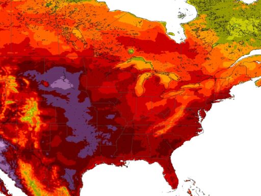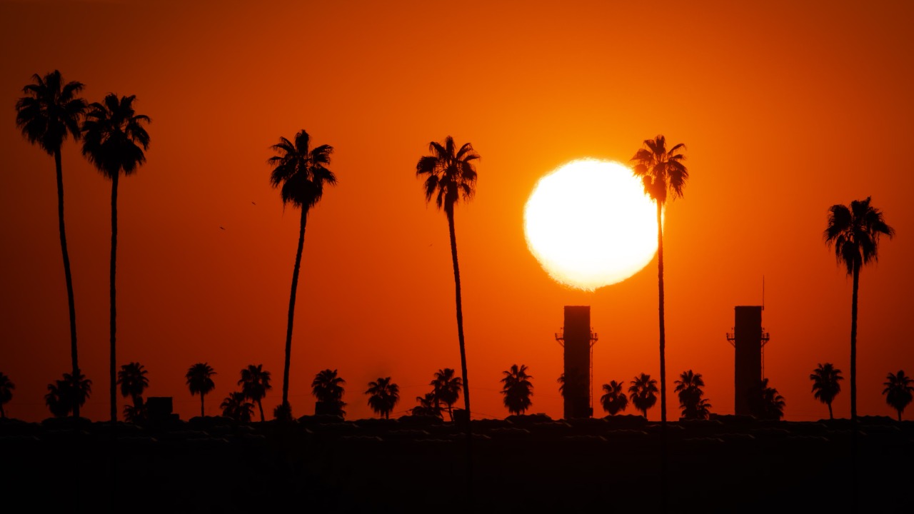
A sprawling pair of heat domes is forecast to park over the central and eastern United States next week, trapping hot, humid air over tens of millions of people. Meteorologists expect the combined system to push heat index values above 110 degrees for roughly 60 million Americans, creating conditions that can quickly turn dangerous for anyone without reliable cooling.
The setup will build on a summer already marked by extreme heat and humidity, with some regions facing their highest stress on power grids, outdoor workers and vulnerable residents so far this year. It also fits a broader trend of longer, more intense heat waves across large parts of the country.
How a “double heat dome” forms and who will feel it
A heat dome occurs when a strong ridge of high pressure stalls over a region and acts like a lid, compressing and warming the air below while blocking cooler systems from moving in. In the coming pattern, two such ridges are projected to strengthen and overlap, one centered over the southern Plains and another over the Mid-Atlantic and Southeast. Their overlap will create a broad zone of sinking, baking air that stretches from Texas and Oklahoma through the Mississippi Valley and into parts of the Midwest and Northeast.
Under that lid, clear skies and light winds allow relentless sunshine to heat the ground each day, while warm nights offer little relief. Moist air flowing north from the Gulf of Mexico will push dew points well into the 70s in many locations, so the heat index, or “feels like” temperature, will climb far above the actual air temperature. In some cities, forecasters expect afternoon heat index readings to top 110 degrees on multiple days, especially where humidity pools along major river valleys and urban cores trap additional warmth.
The pattern resembles earlier extreme events, such as the historic Pacific Northwest heat wave that sent temperatures in Portland and Seattle far beyond previous records and produced widespread stress on infrastructure and health systems. During that event, a powerful ridge locked in place over the region, creating conditions that one analysis described as virtually impossible without climate change, as detailed in coverage of the Pacific Northwest heatwave.
Next week’s double dome will not focus on a single city in the same way, but the breadth of the affected area is striking. Heat advisories and excessive heat warnings are likely to extend across several time zones, affecting residents from smaller farm communities to major metropolitan areas that already struggle with urban heat islands.
Why the next heat surge raises the stakes this summer
Extreme heat is already the deadliest weather hazard in the United States in a typical year, and a multi-day period with heat index values above 110 degrees can sharply increase the risk of heat stroke, dehydration and cardiovascular strain. The danger is highest for older adults, young children, pregnant people, outdoor laborers and anyone with chronic health conditions who lacks access to air conditioning or cooling centers.
Even before this upcoming event, a large share of the country has been living under persistent heat advisories. Earlier this season, around 200 million Americans were under some form of heat alert or flood warning as temperatures spiked across multiple regions, according to a national update that described 200 million Americans facing simultaneous hazards. The new double dome will stack another round of stress on communities that have already endured weeks of high overnight lows, ozone alerts and elevated power demand.
High humidity plays a central role in why this pattern is so dangerous. When dew points climb into the 70s, sweat does not evaporate efficiently from the skin, limiting the body’s ability to cool itself. That is why a 98 degree air temperature with extreme humidity can feel more oppressive than a dry 105 degree day in the desert. In the double dome zone, repeated days of high dew points will keep heat index values in the “extreme caution” and “danger” categories on common heat stress scales.
The heat will also interact with existing vulnerabilities. Many older homes across the Midwest and Northeast were built for cooler climates and lack central air conditioning. In low income neighborhoods, residents often rely on a single window unit or fans that simply recirculate hot air. Outdoor workers in construction, agriculture and delivery services may have limited control over their schedules, especially in states without strong heat safety regulations for employers.
Power grids face their own risks as millions of air conditioners run at full capacity. High overnight temperatures prevent equipment from cooling, which can increase the chance of localized outages or forced conservation measures. If storms flare along the edges of the heat dome, they can bring damaging winds that knock out power just as demand peaks, leaving pockets of residents without cooling during the hottest part of the event.
How communities can prepare for a prolonged, high-impact heat index
With several days of extreme heat index values expected, preparation becomes as important as day-of response. Public health agencies typically urge residents to check on neighbors, especially older adults and those living alone, and to identify cooling centers such as libraries, community centers or shopping malls that will be open during the hottest hours. Cities often extend pool hours, open temporary shelters and coordinate with nonprofits to distribute water and fans.
Households can take simple steps that help limit indoor temperatures. Closing blinds during the day, using reflective window coverings on sun facing rooms and running ceiling fans in the correct direction can reduce the need for air conditioning. In homes with limited cooling capacity, residents are often advised to designate one “cool room,” usually on the lowest floor, and focus fans and window units there as a refuge during the afternoon peak.
For people who must work outside, scheduling heavy labor for early morning or late evening, rotating tasks, and enforcing frequent shade and water breaks can reduce heat illness. Employers can supply electrolyte drinks, lightweight protective clothing and shaded rest areas to help workers recover between tasks. Sports programs and youth camps may need to shorten practices, move activities indoors or cancel outdoor events during the most intense hours.
Local governments also face planning choices. Some cities pre-position mobile cooling buses near large outdoor events or homeless encampments. Others coordinate with utilities to delay nonessential maintenance that could take transformers offline. Emergency managers often review plans for opening additional shelters if forecasts worsen, and they may work with hospitals to anticipate a spike in heat related emergency room visits.
Transportation and infrastructure can feel the strain as well. Prolonged high temperatures can soften asphalt, leading to buckling on highways and runways, and can cause rail lines to expand and warp. Agencies may impose speed restrictions on trains or increase inspections of bridges and tracks, especially where previous heat waves exposed weak points in aging infrastructure.
What this pattern signals about future summers
The double heat dome forming next week is not an isolated curiosity. It fits into a pattern of more frequent, longer lasting and geographically expansive heat waves that climate scientists have been tracking for years. Warmer baseline temperatures mean that when a strong high pressure ridge sets up, it starts from a hotter average and has a higher ceiling for extremes. That helps explain why events like the Pacific Northwest heat wave shattered previous records by such wide margins.
As greenhouse gas concentrations continue to rise, climate models project that what used to be once in a generation heat events will occur more often, sometimes several times within a single decade. For cities and states, that shift turns extreme heat from an occasional emergency into a recurring test of infrastructure, health systems and social safety nets. Power grids must be designed for higher peak loads, water systems for increased demand and emergency plans for repeated activations each summer.