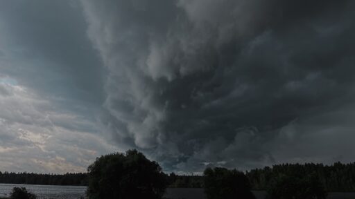
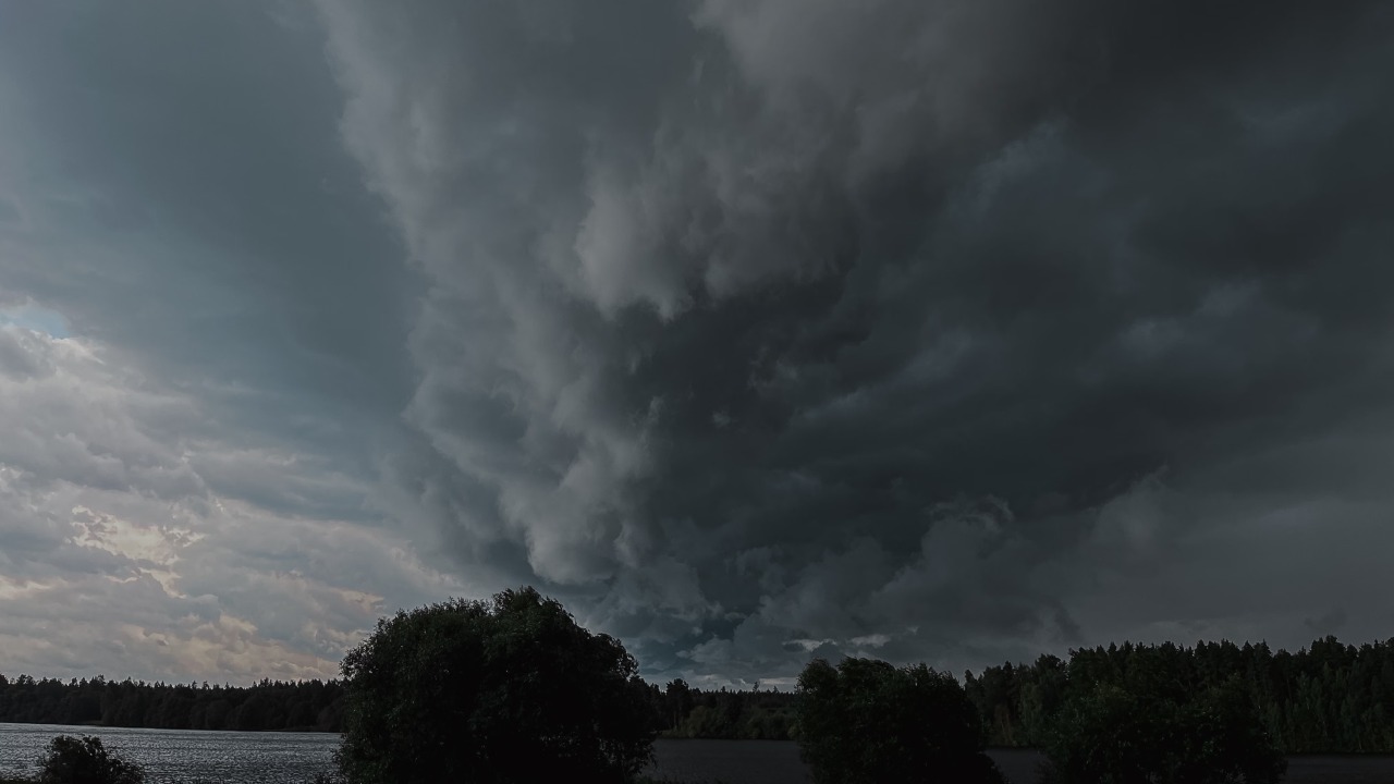

A powerful derecho tore across the Midwest with destructive winds before pushing severe storms toward the Northeast, leaving hundreds of thousands of customers without power and reminding millions of people how dangerous straight-line thunderstorm winds can be. The storm system produced wind gusts up to around 90 mph in parts of the central U.S., strong enough to damage trees, power lines, roofs, vehicles, crops, and outdoor structures.
The event began as clusters of severe thunderstorms over the central Plains and Midwest before organizing into a long-lived windstorm. FOX Weather reported that the derecho blasted the Midwest with gusts up to 90 mph, knocked out power to more than 500,000 customers, and then helped fuel another round of severe weather farther east.
The storm’s biggest danger was not a single tornado. It was the size and speed of the wind field. Derechos can create damage over hundreds of miles, producing widespread destruction in a matter of hours.
What a Derecho Actually Is
A derecho is a long-lived, widespread windstorm associated with a fast-moving band of thunderstorms. The National Weather Service explains that a storm is classified as a derecho when its damaging wind swath extends more than 240 miles and produces wind gusts of at least 58 mph along much of its path. Some derechos produce hurricane-force gusts, even though they are not tropical systems.
The National Weather Service describes derechos as very long-lived and damaging thunderstorm events. The key feature is straight-line wind damage, not rotating tornado damage. The word itself comes from the Spanish word for “straight,” which fits the way these storms often flatten trees, signs, and power poles in the same general direction.
That is why derechos are sometimes called inland hurricanes. The comparison is not perfect, but it helps people understand the danger. A derecho can bring hurricane-force wind gusts far from any coast.
Why 90-MPH Winds Are So Destructive
A 90-mph wind gust is not just a strong thunderstorm breeze. It is a violent force capable of snapping large trees, peeling roofs, flipping trailers, pushing vehicles, shattering windows, and knocking down power poles. It is stronger than the winds produced by many tropical storms and comparable to a low-end hurricane gust.
During this event, the National Weather Service office in Omaha documented severe storms across Nebraska and southwest Iowa, including measured 80-mph gusts near Silver City, Iowa, and Murray, Nebraska, plus estimated 90-mph winds near Essex, Iowa. The NWS Omaha event summary also reported flooding, large hail, and tornadoes in the same outbreak.
That combination made the storm especially dangerous. People were not facing wind alone. They also had to deal with heavy rain, lightning, hail, blocked roads, falling trees, and possible tornado warnings.
The Midwest Took the First Major Hit
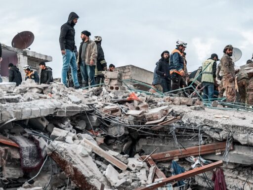
The derecho’s hardest early impacts were felt across the Midwest and Great Lakes region. Northern Illinois, Iowa, Nebraska, Wisconsin, Indiana, and nearby areas saw damaging wind reports, tree damage, power outages, and transportation disruptions.
The National Weather Service office serving Chicago documented the June 10 derecho as a widespread wind-damage event across northern Illinois. Its event summary said the most impactful storms occurred during the afternoon, when a line of thunderstorms produced gusts up to 80 to 85 mph and caused widespread damage across much of northern Illinois.
The same event summary also confirmed two brief EF-0 tornadoes, one southeast of Maple Park and another in the Palos Heights–Alsip area. That detail is important because derechos can produce embedded tornadoes, even though their main signature is straight-line wind.
Why Straight-Line Winds Can Be Confused With Tornadoes
After a derecho, people often assume a tornado hit because the damage can be intense. Trees are snapped, roofs are damaged, buildings lose siding, and debris is scattered across neighborhoods. But straight-line winds can cause similar destruction without a rotating funnel.
The pattern of damage helps meteorologists tell the difference. Tornado damage often shows converging or twisting patterns. Derecho damage often spreads in a more consistent direction along a long swath.
The difference matters scientifically, but for people in the path, the safety advice is similar. When a severe thunderstorm warning mentions destructive winds, it should be treated seriously. Waiting to see a funnel cloud can be a deadly mistake.
The Northeast Faced the Next Round
After the Midwest damage, the broader severe weather setup shifted toward the Northeast. Warm, humid air, storm energy, and a moving front helped create the risk for damaging thunderstorms in states such as New York, Pennsylvania, New Jersey, Connecticut, Massachusetts, Vermont, New Hampshire, and Maine.
The Times Union reported that parts of New York faced extreme heat followed by severe thunderstorm potential, with damaging winds as the primary concern and some storms capable of producing 70-mph gusts, hail, flash flooding, and isolated tornadoes.
This is a common pattern after major Midwest storm systems. The same ingredients that produce severe weather in the central U.S. can travel east, where population density increases and even scattered wind damage can affect millions of people.
Heat and Humidity Helped Fuel the Storms
Derechos often form along the edge of hot, humid air masses. Strong instability builds when warm, moist air sits near the surface, while winds higher in the atmosphere help organize storms into fast-moving lines.
This event followed a period of intense summer heat, with heat advisories and dangerous humidity affecting parts of the Midwest and Northeast. Hot air near the surface provided storm fuel. A front helped lift that air. Strong winds aloft helped thunderstorms organize and maintain themselves.
The result was a severe-weather conveyor belt: storms formed, merged, accelerated, and produced damaging wind over a long distance.
Why Power Outages Spread So Quickly
Derechos are notorious for widespread power outages because they damage power lines over a broad area. A tornado may devastate a narrow path. A derecho can knock down trees and wires across hundreds of miles at once.
FOX Weather reported that more than 500,000 households lost power after the Midwest derecho. Large outage numbers are typical of these events because repair crews may face thousands of separate damage points, blocked roads, and continuing storms.
Power restoration can take longer when damage is widespread. Crews must clear trees, replace poles, restring lines, inspect substations, and prioritize critical facilities. If additional storms follow, restoration becomes even harder.
Why Falling Trees Are One of the Biggest Hazards
In derechos, trees become one of the main dangers. Healthy trees can snap or uproot in extreme winds. Trees weakened by drought, saturated soil, disease, or previous storms may fall more easily.
Falling trees can crush homes, vehicles, power lines, fences, garages, and roads. They can also injure or kill people who are outdoors, inside vehicles, or sheltering in vulnerable parts of a building.
This is why people should move away from windows and exterior walls during destructive thunderstorm winds. A basement, interior room, or lowest-level hallway is safer than a room with large windows or trees nearby.
Why Hail and Flooding Made the Outbreak Worse
The storm system was not only a wind event. Some areas reported large hail and flooding. The NWS Omaha summary described large hail, flooding, and tornadoes along with the severe wind reports. Hail can damage roofs, vehicles, crops, skylights, solar panels, and outdoor equipment. Flooding can close roads and trap drivers.
A derecho can move quickly, but the broader weather pattern can still produce heavy rain. When storms train over the same areas or drop intense rainfall in a short time, flash flooding can happen even after the main wind line has passed.
The combination of wind, hail, lightning, and flooding makes derechos difficult emergencies. People may shelter from wind only to find roads blocked or flooded afterward.
Why Weather Warnings Matter More Than Radar Watching
Many people try to judge storms by looking outside or checking a radar app casually. That can be risky during derechos because the storm line can move extremely fast. Conditions can go from calm to destructive in minutes.
Official warnings from the National Weather Service are designed to give people time to act. A severe thunderstorm warning with destructive winds should trigger immediate sheltering. People should not wait for sirens because sirens are mainly designed for outdoor tornado warnings and may not sound for every damaging wind event.
A weather radio, phone alerts, local broadcast coverage, and trusted weather apps can provide warning before the strongest winds arrive.
What People Should Do During a Derecho
During a derecho warning, people should move indoors immediately. The safest place is a sturdy building, preferably on the lowest floor and away from windows. Interior rooms, basements, bathrooms, hallways, and closets are safer than rooms with exterior walls and glass.
People in mobile homes, tents, campers, or temporary structures should seek stronger shelter before storms arrive. Vehicles are not ideal shelter from falling trees or flying debris, but they may be safer than being outdoors if no building is available.
The worst place to be is outside under trees, near power lines, on a lake, in an open field, or in a lightweight structure when the wind hits.
Why Boaters and Campers Are Especially Vulnerable
Summer derechos often hit during outdoor recreation season. People may be camping, boating, fishing, hiking, attending sports events, working on farms, or traveling. These activities increase risk because shelter may be far away.
A derecho over a lake can create dangerous waves and sudden whiteout rain. Campgrounds can become hazardous because of falling trees and flying debris. Outdoor events can be dangerous if evacuation plans are weak or delayed.
The lesson is simple: when severe storms are forecast, outdoor plans need a safety plan. Waiting until the sky looks scary may be too late.
Why Driving Is Dangerous During These Storms
Driving through a derecho can be extremely dangerous. Heavy rain can reduce visibility to near zero. Crosswinds can push high-profile vehicles. Falling trees and power lines can block roads. Debris can strike windshields. Flooded roads can trap vehicles.
Drivers should avoid travel during severe thunderstorm warnings when possible. If already on the road, they should avoid parking under trees, stay away from downed wires, never drive through floodwater, and pull over only if it can be done safely away from trees and power lines.
Overpasses are not safe shelters from severe wind. They can create wind-tunnel effects and expose people to debris.
Why Downed Power Lines Are Deadly
After a derecho, downed power lines are one of the most dangerous hazards. A wire on the ground may still be energized even if it is not sparking. Wet ground, metal fences, vehicles, tree limbs, and puddles can carry current.
People should stay far away from downed lines and call emergency services or the utility company. If a power line falls on a vehicle, the safest move is usually to stay inside unless there is fire or immediate danger. If escape is necessary, people should jump clear without touching the vehicle and ground at the same time, then shuffle away with feet close together.
Cleanup should not begin until electrical hazards are identified.
Why Generators Can Become a Second Disaster
Power outages often lead people to use portable generators. Generators can be lifesaving when used correctly, but deadly when used indoors or too close to homes.
The CDC warns that generators should never be used inside homes, garages, basements, crawl spaces, or near windows because they can produce carbon monoxide, an invisible and odorless gas that can kill quickly.
After major windstorms, carbon monoxide poisonings often rise because people are desperate to restore power. The generator should always stay outside and far from doors, windows, and vents.
Why Derechos Can Be Hard to Forecast Precisely
Meteorologists can identify environments favorable for derechos, but predicting the exact path, timing, and intensity is difficult. Thunderstorm complexes depend on small-scale interactions, outflow boundaries, instability, wind shear, and storm mergers.
A forecast may identify a broad risk area hours or days ahead, but the most destructive wind corridor may become clear only closer to the event. That uncertainty is why people in the broader risk zone should prepare even if they are not guaranteed to be hit.
Severe weather preparedness should not wait for certainty. By the time certainty arrives, the storm may be close.
Why The 2020 Iowa Derecho Still Shapes Public Memory
Many people remember the August 2020 Midwest derecho, which devastated parts of Iowa and neighboring states with extreme winds, crop damage, long power outages, and billions of dollars in losses. That event showed how destructive straight-line wind can be.
The new derecho was not necessarily the same scale as the 2020 disaster, but comparisons are natural because both involved violent winds across the Midwest. The 2020 event helped make the word “derecho” more familiar to Americans who had never heard it before.
The broader lesson remains the same. Straight-line wind can be as dangerous as the storms people fear more instinctively.
Why Climate Change May Influence Derecho Risk
Scientists are still studying exactly how climate change may affect derechos. The relationship is complex because derechos depend on instability, moisture, wind patterns, and storm organization. A warmer atmosphere can hold more moisture and may increase the fuel available for severe thunderstorms, but wind shear patterns also matter.
What is clearer is that extreme precipitation and heat are increasing in many regions, and severe storm environments can be intensified by hot, humid air. The National Climate Assessment notes that heavy precipitation and extreme heat are increasing in the United States, both of which can worsen storm impacts and recovery challenges.
For communities, the practical message is not to wait for perfect climate attribution. Stronger infrastructure, better warnings, tree management, backup power planning, and emergency preparation are needed now.
Why Communities Need Better Wind Resilience
Derechos expose weaknesses in infrastructure. Overhead power lines, aging trees, weak roofs, poorly secured signs, temporary structures, and vulnerable communications systems can all fail under extreme wind.
Communities can reduce risk by improving tree maintenance near power lines, strengthening building codes, burying critical lines where practical, hardening substations, expanding backup power for hospitals and shelters, and improving public warning systems.
Wind resilience is not only a coastal hurricane issue. Inland communities need it too.
What Homeowners Should Check After the Storm
After a derecho, homeowners should inspect roofs, gutters, siding, windows, fences, sheds, garages, vehicles, and trees. They should look for roof leaks, lifted shingles, broken branches hanging overhead, damaged electrical service, and water intrusion.
People should photograph damage before cleanup for insurance purposes. They should avoid climbing on damaged roofs or using chainsaws near power lines. Hiring licensed professionals is safer for major repairs.
Storm scammers often appear after disasters, so homeowners should be cautious of door-to-door contractors demanding large upfront payments or refusing written estimates.
Why This Storm Was a Reminder, Not an Outlier
Derechos are uncommon, but they are not freak events. The National Weather Service notes that damaging thunderstorm wind events occur across the United States, and derechos are most common in parts of the central and eastern U.S. during the warm season.
This event was a reminder that severe thunderstorm warnings are not minor alerts. A storm does not need a tornado warning to be life-threatening. Destructive straight-line winds can hit more people over a wider area than a tornado.
When forecasters warn of damaging winds, people should respond with the same seriousness they would bring to other major hazards.
Final Takeaway
A derecho blasted the Midwest with destructive winds up to around 90 mph before the broader severe-weather threat shifted toward the Northeast. The storm knocked out power to more than 500,000 customers, damaged trees and infrastructure, and brought additional hazards including hail, flooding, and embedded tornadoes.
Official National Weather Service summaries documented wind gusts up to 80 to 85 mph across northern Illinois and estimated 90-mph winds near Essex, Iowa. The system showed why derechos are so dangerous: they can produce hurricane-force straight-line winds over hundreds of miles without being tropical storms.
The practical message is simple. Treat destructive thunderstorm wind warnings seriously, shelter inside a sturdy building, stay away from windows, avoid driving through storms, never touch downed power lines, and use generators only outdoors. A derecho may not look like a hurricane or tornado on the horizon, but it can leave a damage path that feels just as violent.