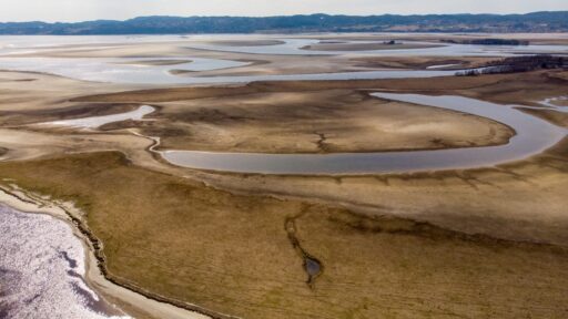
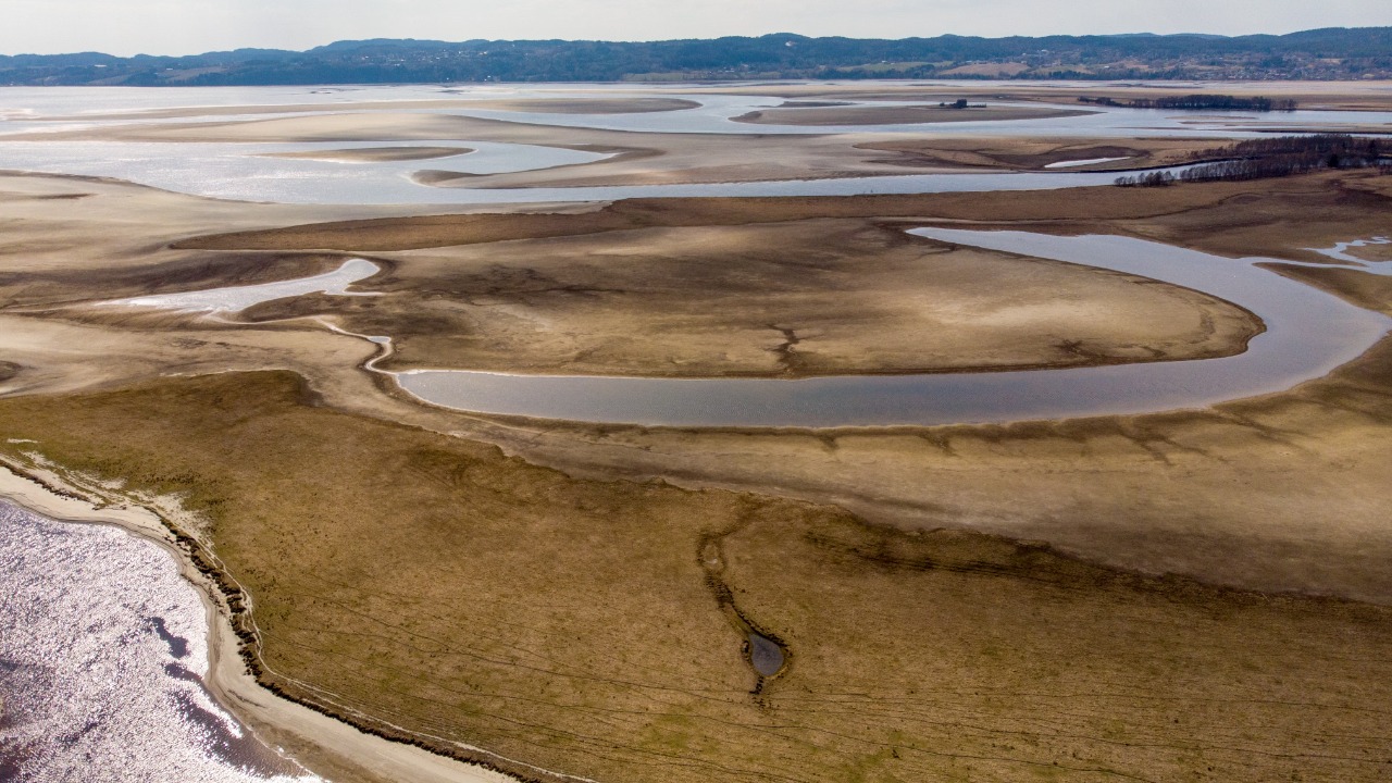

Some of Europe’s most important rivers have fallen to exceptionally low levels after months of limited rainfall and repeated heatwaves. The changes are now so extensive that satellites can clearly identify exposed sandbanks, narrowed channels and sections of riverbed that would normally remain underwater.
Images captured by the European Union’s Copernicus Sentinel-2 satellites between August 1 and 3, 2026, show severely reduced water levels along the Loire near Saumur in France, the Po near Cremona in Italy, the Rhine near Boppard in Germany and the Danube near Paks in Hungary.
The images do not show that these rivers have completely disappeared. They reveal something almost as concerning: waterways central to European transport, energy, farming and wildlife are losing enough water to disrupt the systems built around them.
According to the EU Space Programme’s Copernicus imagery, the exposed riverbanks can be mapped from orbit and compared with earlier observations to measure changes in surface-water coverage. The differences are becoming visible not only in scientific data but in the physical shape of the continent’s rivers.
Satellite Images Reveal a Continental Water Crisis
Satellite monitoring allows researchers and governments to observe large river systems in ways that ground measurements alone cannot. River gauges provide precise information at individual locations, while satellite images reveal how the water’s width, channels and exposed sediment are changing across a much larger area.
A Copernicus comparison of the Danube in northern Hungary shows how much the landscape changed between July 2025 and July 2026. Pale sediment bars that were previously submerged are now visible along several bends, while sections of the navigable channel have become considerably narrower.
These images are useful for more than documenting a dramatic environmental event. Authorities can use them to assess shipping conditions, identify habitats under pressure and understand where water-management intervention may be required.
The current crisis is especially significant because it is affecting several major river basins at the same time. Europe is not dealing with one isolated waterway experiencing an unusual local dry spell. The Loire, Rhine, Po and Danube cross different climates, landscapes and economies, yet each is showing the consequences of prolonged dryness and extreme heat.
The Danube Has Reached Historic Lows
The situation along the Danube is among the most severe. In Budapest, the river reportedly fell to approximately 10 centimetres at a key measuring point, well below the previous record low of 33 centimetres set in 2018.
The Danube is Europe’s second-longest river and passes through or borders ten countries. It supports freight transportation, tourism, agriculture, drinking-water systems and electricity production from Germany to the Black Sea.
Low levels have already interrupted sightseeing services and commercial navigation. In some areas, ships have been stranded or forced to carry lighter loads. Parts of the riverbed have become accessible on foot, while previously submerged Second World War wrecks have reappeared near Serbia.
The energy consequences are even more serious. Hungary’s Paks nuclear power station depends on Danube water for cooling. Its output fell to approximately 240 megawatts, compared with a normal capacity of around 2,000 megawatts, pushing the country to reduce electricity use and increase imports.
Romania has faced similar pressure. The Danube’s flow there dropped to around 1,500 cubic metres per second, less than one-third of its average July rate. One reactor at the Cernavoda nuclear plant was shut down, while authorities used controlled underwater explosions near the Bala Canal to improve the movement of water toward the facility.
Low Rhine Levels Threaten Europe’s Industrial Supply Chains
The Rhine is one of Europe’s most economically important transportation routes. It connects industrial regions in Germany, Switzerland and France with ports in the Netherlands, including Rotterdam.
When the river becomes shallow, cargo vessels cannot be loaded to their normal capacity. Heavy ships carrying chemicals, fuel, coal or industrial materials sit deeper in the water and are therefore particularly vulnerable to reduced depth.
The volume of cargo transported between Rotterdam and the Rhine was around 10 percent below normal by late July. Companies may need to use more vessels to move the same amount of material or shift freight to road and rail, increasing transportation costs.
The problem can spread far beyond businesses located beside the river. German factories depend on the Rhine for raw materials and fuel. When shipping capacity falls, production costs can rise and delivery schedules can become less reliable.
Reuters’ analysis of Europe’s shrinking rivers found that the crisis is affecting transportation, electricity production and corporate earnings across the continent.
The Po River Crisis Threatens Food and Fresh Water
Italy’s Po River supports one of Europe’s most productive agricultural regions. Its basin supplies water to rice fields, livestock farms, food-processing businesses and major cities across northern Italy.
The basin has now entered a state of high water scarcity. Reduced river flow is threatening crops, hydropower generation and drinking-water supplies.
Low freshwater flow also allows salt water from the Adriatic Sea to travel farther into the Po Delta. This saltwater intrusion can make river water unsuitable for irrigation and damage freshwater ecosystems.
Rice production is especially vulnerable because flooded fields require reliable water supplies throughout critical parts of the growing season. Restrictions or shortages can reduce yields and increase costs for farmers already facing heat stress and higher energy prices.
Italian utilities are also reporting pressure on reservoirs and hydropower output. Lower electricity generation from water can increase dependence on imported power or fossil-fuel plants precisely when air-conditioning demand is rising.
The Loire Shows That Western Europe Is Not Protected
The Loire is France’s longest river and supports drinking-water supplies, agriculture, tourism and internationally important ecosystems.
Satellite images near Saumur show that unusually low water has divided parts of the river into narrower channels separated by large exposed areas. Such changes can affect fish movement, water temperature and oxygen availability.
Shallow rivers heat more quickly during hot weather. Warmer water contains less dissolved oxygen, creating additional stress for fish and other aquatic organisms. Low flows can also concentrate pollutants because less water is available to dilute them.
France has already reduced output at some nuclear facilities because rivers were either too warm or too low to provide normal cooling without creating additional environmental harm. The country’s energy system therefore faces the same contradiction appearing elsewhere in Europe: electricity demand increases during heatwaves while the rivers needed by some power stations become less capable of supporting production.
Why Europe’s Rivers Are Losing So Much Water
The immediate cause is a combination of insufficient rainfall and persistent high temperatures.
Much of western, central and eastern Europe experienced below-average precipitation during spring and early summer. By June, low-flow conditions were affecting river systems across France, Germany, Switzerland, Poland, Hungary, Italy and the wider Danube region.
The Copernicus Climate Change Service’s June assessment found that persistent high pressure restricted rainfall while exceptional temperatures increased the loss of moisture from soils and vegetation.
Heat makes a rainfall shortage more damaging. Higher temperatures increase evaporation from rivers, reservoirs and soil. Plants also release more water into the atmosphere through transpiration. As a result, rainfall levels that may once have caused moderate dryness can now produce a much more severe drought.
The crisis has developed differently across the continent. Western Europe experienced relatively wet conditions earlier in the year before shifting rapidly into extreme dryness. Parts of eastern Europe entered 2026 with existing precipitation deficits carried over from the previous year.
Climate Change Is Intensifying the Drought
Low rainfall has always occurred naturally in Europe, and climate change does not create every dry period. However, rising temperatures are making those periods more damaging.
A study by World Weather Attribution concluded that the 2026 European drought is a compound crisis driven by both prolonged rainfall deficits and extreme heat.
The researchers estimated that the soil-moisture drought observed in western Europe became approximately five times more likely in the current climate than it would have been in a world 1.4°C cooler. In eastern Europe, comparable soil-moisture deficits became around 11 times more likely.
The analysis found that climate change had greatly increased atmospheric demand for moisture. Highly evaporative conditions like those experienced in western Europe became approximately 80 times more likely, while the equivalent conditions in eastern Europe became around 40 times more likely.
One Storm Will Not Restore the Rivers
Heavy thunderstorms may temporarily improve conditions in individual locations, but they are unlikely to reverse a drought of this scale.
Very dry ground can struggle to absorb intense rain. Water may run across the surface and cause flash flooding rather than slowly replenishing groundwater, reservoirs and rivers.
River recovery requires sustained rainfall across entire catchment areas. Rain must fall in the correct upstream regions and continue long enough to rebuild soil moisture and groundwater reserves.
Europe’s satellite images are therefore not merely dramatic photographs of a hot summer. They reveal a growing structural risk. Rivers designed into the continent’s energy, transportation and food systems can no longer be assumed to provide the same dependable conditions every year.
The shrinking channels of the Loire, Po, Rhine and Danube are visible from space, but their consequences are being experienced on the ground through disrupted shipping, reduced electricity, threatened harvests and damaged ecosystems.