
Satellites have captured striking images of the aftermath from Ethiopia’s Hayli Gubbi volcano, which erupted for the first time in recorded history as a once-in-10,000-year event. This rare activity, detected in late November 2025, reveals fresh lava flows and thermal signatures reshaping the Erta Ale region in the Danakil Depression. The imagery provides unprecedented insights into the volcano’s sudden awakening, highlighting environmental shifts not seen in modern observations.
Discovery of the Eruption
Scientists first recognized that Hayli Gubbi had awakened when ground-based monitoring stations in Ethiopia’s Afar Region picked up unusual seismic activity and gas emissions that did not match the area’s typical tectonic background. Instruments that routinely track tremors and volcanic gases across the Erta Ale segment of the Danakil Depression flagged a cluster of signals around November 25, 2025, indicating magma movement beneath the surface and the onset of an eruption. Those early readings marked the site’s first documented eruption, transforming what had long been treated as a dormant feature into an active volcano that suddenly demanded close scrutiny.
Historical records and prior geological surveys of the Afar Region had not identified any previous eruptions from Hayli Gubbi, which is why researchers now describe the event as a once-in-10,000-year episode based on recurrence estimates reported for the volcano. Coverage of Ethiopia’s Hayli Gubbi volcano as a once-in-10,000-year eruption underscores how far this activity falls outside the range of modern observations in the region. For local communities and hazard planners, that rarity raises the stakes, because it means there is little direct historical experience to guide expectations about how long the eruption might last or how the volcano might behave as it evolves.
Satellite Monitoring Activation
Once the ground network confirmed that Hayli Gubbi had entered an eruptive phase, regional and international teams rapidly tasked infrared and multispectral satellites to focus on the Afar Region. These orbiting platforms, which routinely scan tectonically active zones, were redirected to track the eruption’s progression in near real time, capturing the heat signatures of rising magma and the spread of new lava flows. By combining thermal data with visible and shortwave infrared imagery, analysts could distinguish between cooling older flows and freshly erupted material, a distinction that is critical for assessing how quickly the eruption front is advancing across the Erta Ale landscape.
As the satellites continued to pass over the Danakil Depression, they recorded thermal anomalies and ash plumes emanating from Hayli Gubbi that would have been difficult to quantify from ground level alone. Imagery highlighted concentrated hot spots at new vents and along fissures, while plume tracking helped estimate how high ash and gas were being injected into the atmosphere. According to orbital assessments summarized in reporting on satellites capturing the aftermath of the Ethiopian volcano’s first recorded eruption, updates from November 29, 2025, showed an escalation in lava output compared with earlier scans, signaling that the eruption had intensified rather than waned in its first days. That trend matters for emergency managers, because sustained or increasing lava discharge can prolong environmental disruption and complicate any future evacuation planning.
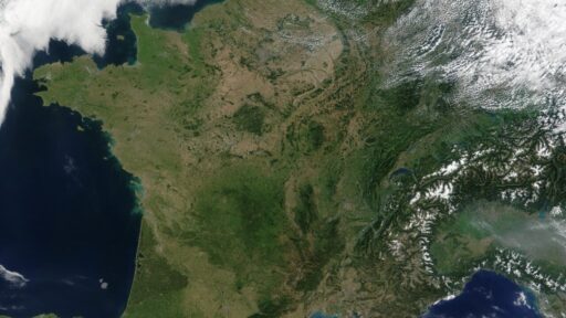
Visual Evidence from Orbit
High-resolution satellite images taken after the eruption began reveal a transformed Hayli Gubbi caldera, with fresh fissures cutting across the surface and glowing lava fields spreading into previously unscarred terrain. The Danakil Depression, already known for its stark volcanic landscapes, now shows new tongues of basaltic lava radiating from the volcano, their outlines sharply defined in thermal and multispectral views. In several passes, sensors captured the contrast between dark, cooled crust and intensely hot flow interiors, providing a detailed map of where molten rock continues to move beneath a thin solidified skin.
Before-and-after comparisons assembled from orbital archives illustrate just how abruptly the landscape has changed since the eruption’s start. Areas that earlier imagery showed as relatively stable volcanic plains now host new vent formations and elongated fractures that align with the regional rift system, indicating that magma exploited existing structural weaknesses as it rose. Publicly shared composites, highlighted in coverage of satellites capturing the aftermath of Ethiopian volcano’s first eruption in recorded history, document the visual impact of this transition from dormancy to activity, giving researchers and the public alike a clear view of how a once-quiet volcano can reshape its surroundings in a matter of days. For scientists studying continental rifting, those images offer a rare, time-stamped record of how new crust is emplaced along one of Earth’s most active tectonic boundaries.
Emerging Aftermath Impacts
Beyond the dramatic visuals, the satellite data are already informing early assessments of environmental change in Ethiopia’s Afar Region. Analysts are examining ash distribution patterns to determine where fine particles may have settled on soils, vegetation, and water sources downwind of Hayli Gubbi, a factor that can influence everything from grazing conditions to air quality. Thermal signatures persisting around the volcano indicate that hot material remains close to the surface, which can drive continued gas emissions and localized heating of the ground, with potential consequences for fragile desert ecosystems in the Erta Ale area.
For nearby communities, the most immediate concern is whether the eruption poses a direct threat to settlements or key infrastructure, and current satellite interpretations suggest there are no immediate hazards of lava overrunning populated areas. However, the same imagery that shows lava confined to remote parts of the Danakil Depression also reveals ongoing seismic and thermal activity that confirms Hayli Gubbi has shifted from a dormant status to an active one. Reporting that describes thermal signatures persisting beyond the initial November 2025 event underscores why scientists are maintaining continuous monitoring, since renewed pulses of magma or changes in gas output could alter risk levels with little warning. In a region where pastoral livelihoods and cross-border trade routes already contend with extreme heat and limited resources, any long-lived volcanic disturbance has the potential to compound existing vulnerabilities.