NASA, in collaboration with the European Space Agency (ESA), is set to broadcast the launch of the Sentinel-6B ocean monitoring satellite. This mission, which will be carried out aboard a SpaceX Falcon 9 rocket, aims to provide real-time tracking of Earth’s oceans for sea-level monitoring. Scheduled for early November 17 from Vandenberg Space Force Base in California, this launch represents a significant advancement in international ocean tracking efforts, enhancing the capabilities established by its predecessor, Sentinel-6A.
Mission Overview
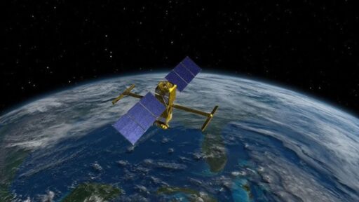
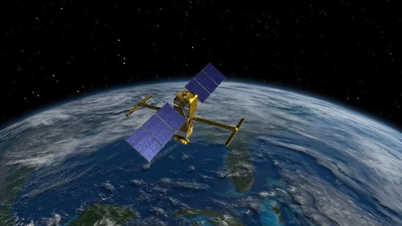
The Sentinel-6B satellite is the second in a series of radar altimetry missions designed to deliver high-precision measurements of global sea levels. Building on the success of Sentinel-6A, launched in 2020, Sentinel-6B will continue to provide critical data on ocean topography, sea-level rise, and ocean circulation patterns. This mission is part of the Copernicus program, a joint initiative by the European Union and ESA, which focuses on monitoring the impacts of climate change.
Equipped with advanced instruments such as the Poseidon-4 radar altimeter, Sentinel-6B will offer accurate real-time monitoring of ocean topography and wave heights. This technology will enable scientists to track changes in sea surface height with unprecedented precision, contributing to a better understanding of global warming’s effects on the oceans. The data collected will be crucial for climate research and policy-making, providing insights into the long-term trends of sea-level rise and its implications for coastal communities worldwide.
Launch Preparations and Timeline
The launch window for Sentinel-6B opens at 5:20 p.m. PST on November 17, 2025, from Space Launch Complex 4 East at Vandenberg. Recent updates to the mission schedule have confirmed this timing, ensuring that all systems are go for this critical launch. The Falcon 9 rocket, configured specifically for this mission, will utilize a first-stage booster that has previously flown on 18 missions, highlighting SpaceX’s reliability in delivering payloads to polar orbits ideal for ocean observation.
Final payload integrations have been completed, allowing the satellite to reach its intended 1,336-kilometer sun-synchronous orbit. This orbit is optimal for continuous monitoring of the Earth’s oceans, providing comprehensive coverage necessary for the mission’s objectives. The meticulous planning and execution of these preparations underscore the importance of this mission in advancing our understanding of ocean dynamics and climate change.
Live Broadcast Coverage
NASA’s launch coverage will begin two hours before liftoff, available on NASA+, YouTube, and the agency’s website. Prelaunch briefings are scheduled for November 14 at 1 p.m. EST, offering detailed insights into the mission’s objectives and technical specifications. ESA will also provide live broadcast options, streaming the event on their website and social channels from 30 minutes prior, with multilingual commentary to cater to a global audience.
SpaceX will synchronize its webcast with the November 17 timeline, capturing the ascent and deployment phases in real time. This comprehensive coverage ensures that audiences worldwide can witness the launch and understand its significance in the context of global ocean monitoring efforts. The collaboration between NASA, ESA, and SpaceX in providing extensive broadcast options reflects the mission’s international importance and the shared commitment to advancing Earth observation capabilities.
Scientific Goals and Data Applications
Sentinel-6B will measure sea surface height with centimeter-level accuracy, contributing to long-term datasets that have been instrumental in understanding the effects of global warming on oceans since 1992. This data is vital for a range of applications, including tsunami warning systems, marine forecasting, and coastal management. By providing open access to this information via the Copernicus Open Access Hub, researchers worldwide can leverage these insights to advance scientific knowledge and inform policy decisions.
The mission’s ability to offer twice the measurement frequency over key areas compared to previous satellites represents a significant enhancement in ocean monitoring capabilities. This increased frequency will enable more detailed analyses of ocean dynamics, supporting efforts to mitigate the impacts of climate change on vulnerable coastal regions. The data collected by Sentinel-6B will play a crucial role in bridging gaps in our understanding of ocean behavior, facilitating more effective responses to environmental challenges.
International Partnership Dynamics
The Sentinel-6B mission exemplifies the collaborative efforts between NASA, ESA, the European Commission, and NOAA. NASA is providing the launch services and a U.S. payload instrument for enhanced laser ranging, while ESA and the European Commission contribute to the satellite’s development and data dissemination. This partnership underscores the importance of international cooperation in addressing global challenges such as climate change.
SpaceX’s role in launching the Falcon 9 rocket highlights the benefits of public-private partnerships in reducing costs and accelerating the deployment of critical Earth observation satellites. The 1,150-kilogram Sentinel-6B represents a significant investment in our planet’s future, with stakeholders issuing joint press releases on November 14 to emphasize the strengthened ties and shared goals for future Copernicus missions. These collaborations are essential for advancing our understanding of climate dynamics and developing effective strategies to address them.
Broader Impacts on Earth Observation
Data from Sentinel-6B will support the United Nations Sustainable Development Goals, particularly in tracking ocean health and biodiversity amid a sea-level rise of 3.7 mm per year. This mission is timely, launching as global ocean temperatures reach record highs, providing critical information to inform adaptation strategies for vulnerable coastal regions. The insights gained from this mission will be instrumental in shaping policies that address the challenges posed by climate change.
Post-launch operations will commence with initial data downlink expected within days, feeding into real-time models for weather prediction and environmental alerts. This rapid availability of data will enhance our ability to respond to environmental changes and improve the accuracy of forecasts. The Sentinel-6B mission represents a significant step forward in our capacity to monitor and understand the Earth’s oceans, offering valuable insights that will inform decision-making and contribute to a more sustainable future.